MyTopo
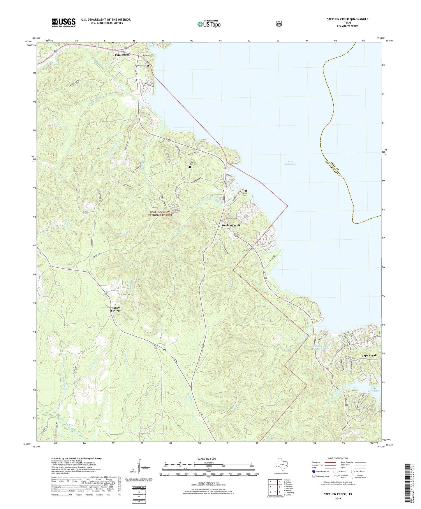
Stephen Creek Texas US Topo Map
Couldn't load pickup availability
Also explore the Stephen Creek Forest Service Topo of this same quad for updated USFS data
2022 topographic map quadrangle Stephen Creek in the state of Texas. Scale: 1:24000. Based on the newly updated USGS 7.5' US Topo map series, this map is in the following counties: San Jacinto, Polk. The map contains contour data, water features, and other items you are used to seeing on USGS maps, but also has updated roads and other features. This is the next generation of topographic maps. Printed on high-quality waterproof paper with UV fade-resistant inks.
Quads adjacent to this one:
West: Oakhurst
Northwest: Staley
North: Carlisle
Northeast: Onalaska
East: Blanchard
Southeast: Camilla
South: Coldspring
Southwest: Maynard
This map covers the same area as the classic USGS quad with code o30095f2.
Contains the following named places: Big Spring Creek, Caney Creek, Cape Royale Census Designated Place, Carter Cemetery, Cedar Lick Branch, City of Point Blank, Coldspring Volunteer Fire Department Substation, Dobbins Creek, Harrell Cemetery, McCombs Creek, McGee Creek, Mill Creek, Morris Creek, Mount Zion Cemetery, Paul Horton Memorial Church, Pointblank, Pointblank Post Office, Robinson Cemetery, Rocky Creek, San Jacinto County Constable's Office Precinct 4, San Jacinto County First Responders, Snow Hill, Snow Hill Church, Stephen Creek, Willow Springs, Willow Springs Lookout, Wolf Creek, Wolf Creek Park, Woodlands Golf Course Lake, Woodlands Golf Course Lake Dam, ZIP Code: 77331