MyTopo
Bledsoe Texas US Topo Map
Couldn't load pickup availability
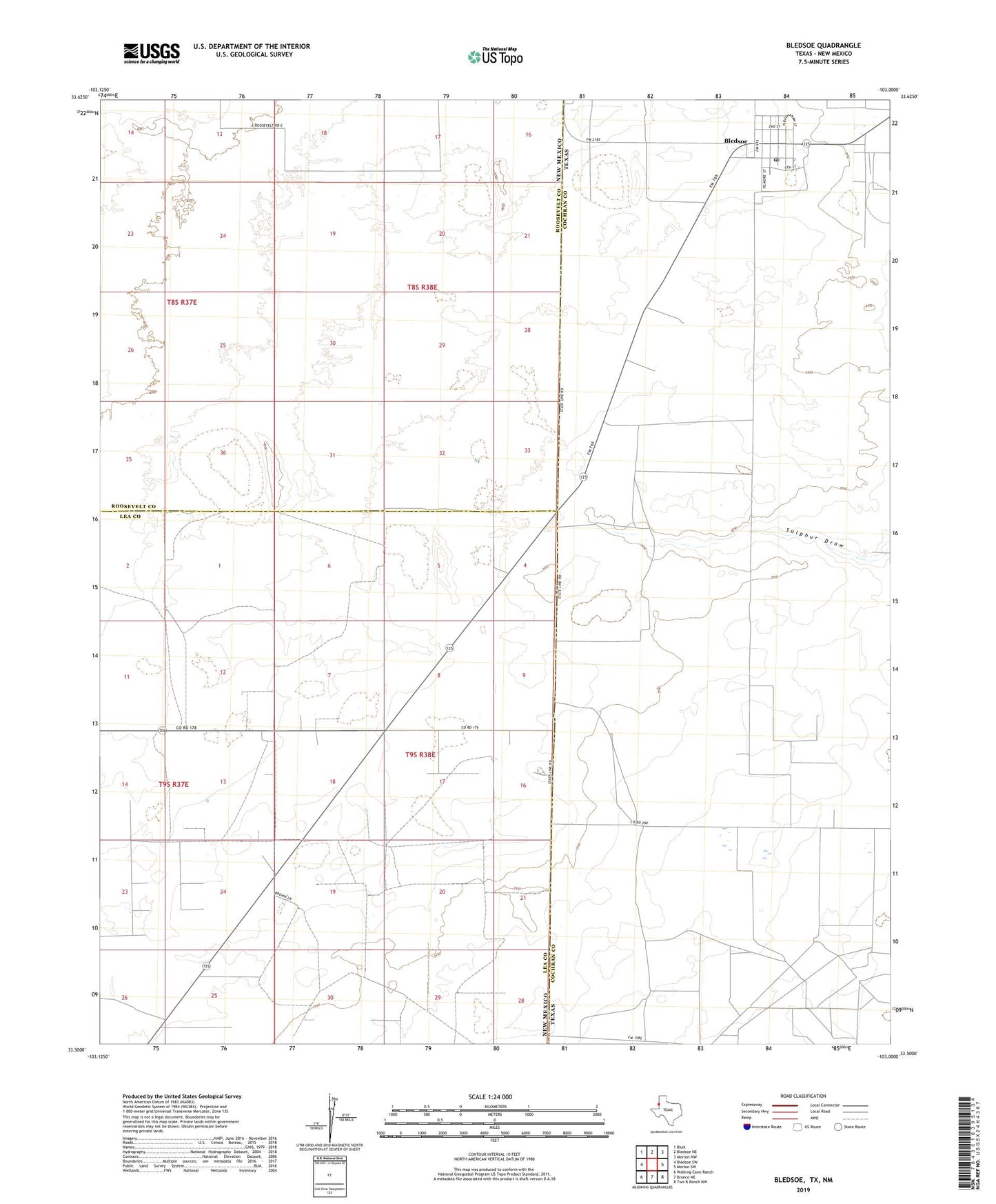
2022 topographic map quadrangle Bledsoe in the states of New Mexico, Texas. Scale: 1:24000. Based on the newly updated USGS 7.5' US Topo map series, this map is in the following counties: Cochran, Lea, Roosevelt. The map contains contour data, water features, and other items you are used to seeing on USGS maps, but also has updated roads and other features. This is the next generation of topographic maps. Printed on high-quality waterproof paper with UV fade-resistant inks.
Quads adjacent to this one:
West: Bledsoe SW
Northwest: Bluit
North: Bledsoe NE
Northeast: Morton NW
East: Morton SW
Southeast: Two B Ranch NW
South: Bronco NE
Southwest: Walking Cane Ranch
This map covers the same area as the classic USGS quad with code o33103e1.
Contains the following named places: 12560 Water Well, 12563 Water Well, 12564 Water Well, 12565 Water Well, 12620 Water Well, 12627 Water Well, 12632 Water Well, 12633 Water Well, 12637 Water Well, 12638 Water Well, 12639 Water Well, 12640 Water Well, 12641 Water Well, 13376 Water Well, 13377 Water Well, 79314, Bledsoe, Bledsoe Census Designated Place, Bledsoe Post Office