MyTopo
Bonita Texas US Topo Map
Couldn't load pickup availability
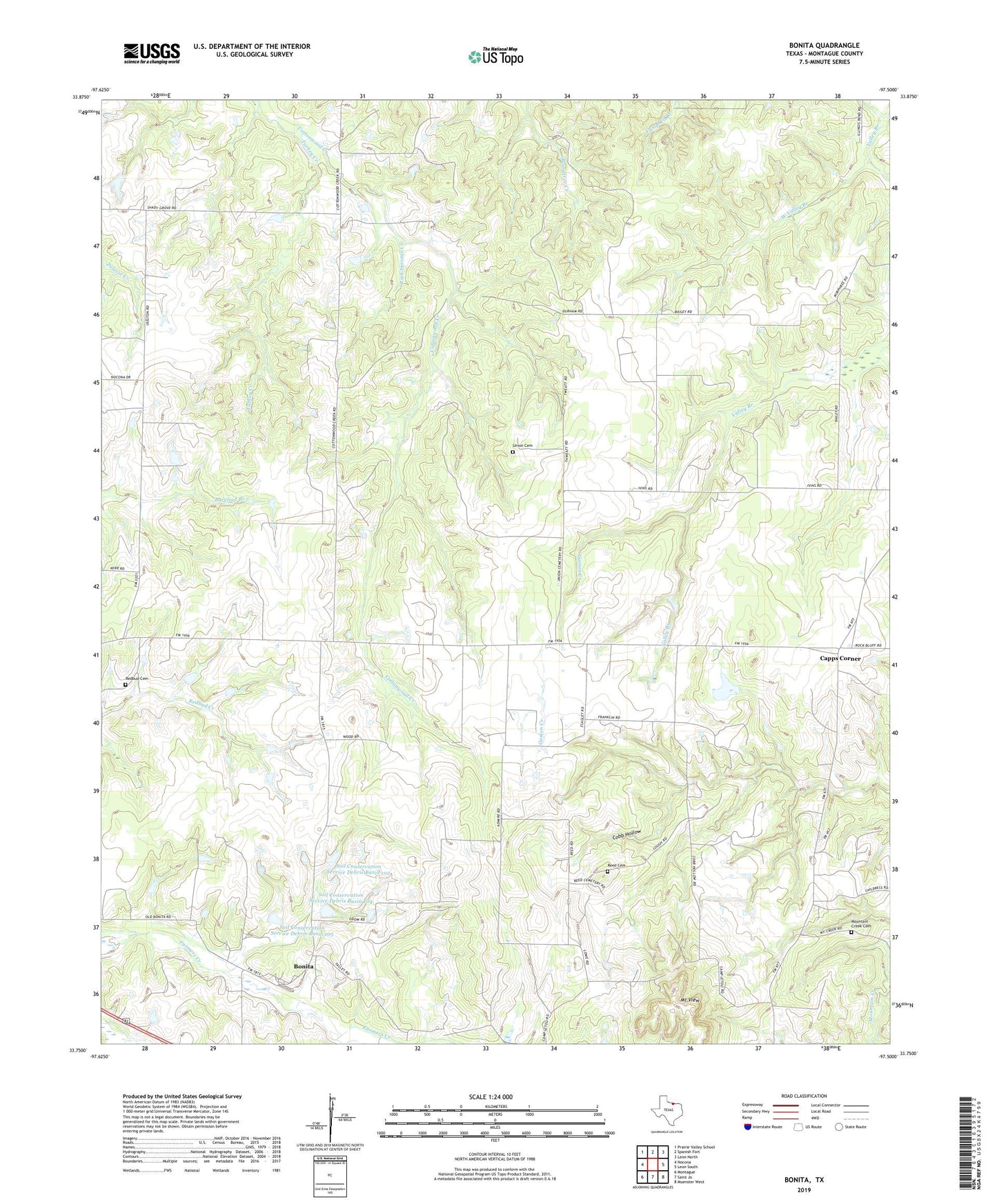
2019 topographic map quadrangle Bonita in the state of Texas. Scale: 1:24000. Based on the newly updated USGS 7.5' US Topo map series, this map is in the following counties: Montague. The map contains contour data, water features, and other items you are used to seeing on USGS maps, but also has updated roads and other features. This is the next generation of topographic maps. Printed on high-quality waterproof paper with UV fade-resistant inks.
Quads adjacent to this one:
West: Nocona
Northwest: Prairie Valley School
North: Spanish Fort
Northeast: Leon North
East: Leon South
Southeast: Muenster West
South: Saint Jo
Southwest: Montague
Contains the following named places: Bonita, Bowers Oil Field, Camp Letoli, Capps Corner, Corinth, Gaston Creek, Mount View, Mountain Creek Cemetery, Redbud Cemetery, Reed Cemetery, Rock Springs Creek, Saint Jo Division, Shady Grove Church, Soil Conservation Service Debris Basin 102, Soil Conservation Service Debris Basin 102 Dam, Soil Conservation Service Debris Basin 104, Soil Conservation Service Debris Basin 104 Dam, Soil Conservation Service Debris Basin 105, Soil Conservation Service Debris Basin 105 Dam, Spencer Church, Turkey Creek, Union Cemetery, West Valley Branch, Wilderness Point Airport, ZIP Code: 76265