MyTopo
Nocona Texas US Topo Map
Couldn't load pickup availability
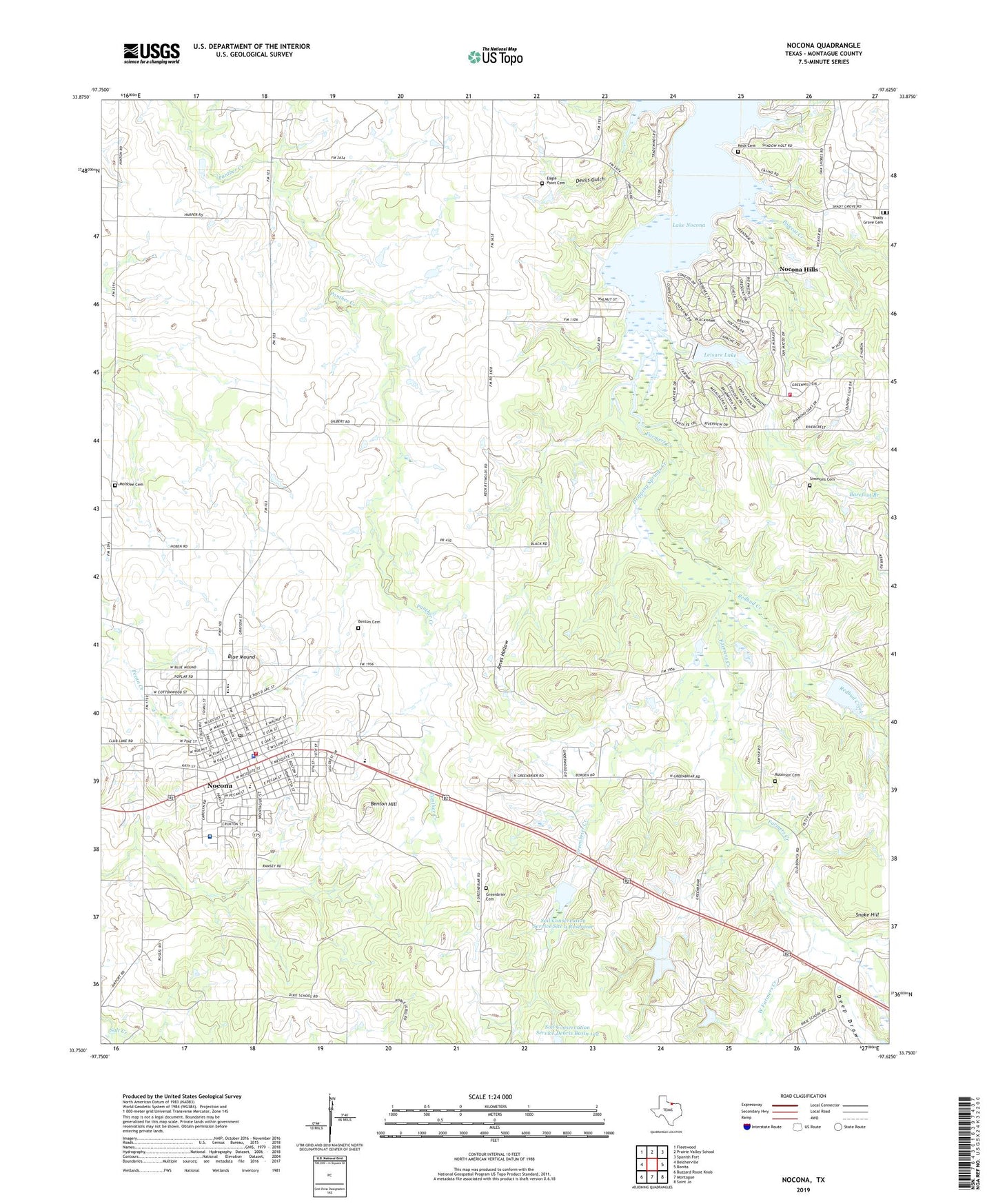
2022 topographic map quadrangle Nocona in the state of Texas. Scale: 1:24000. Based on the newly updated USGS 7.5' US Topo map series, this map is in the following counties: Montague. The map contains contour data, water features, and other items you are used to seeing on USGS maps, but also has updated roads and other features. This is the next generation of topographic maps. Printed on high-quality waterproof paper with UV fade-resistant inks.
Quads adjacent to this one:
West: Belcherville
Northwest: Fleetwood
North: Prairie Valley School
Northeast: Spanish Fort
East: Bonita
Southeast: Saint Jo
South: Montague
Southwest: Buzzard Roost Knob
This map covers the same area as the classic USGS quad with code o33097g6.
Contains the following named places: American Legion Park, Barefoot Branch, Benton Cemetery, Benton Hill, Blue Mound, Church of Christ, Church of the Nazarene, City of Nocona, Deep Draw, Devils Gulch, Dripping Springs Creek, Eagle Point Cemetery, First Baptist Church, Greenbrier Cemetery, Greenbrier Creek, Jones Hollow, Keck Cemetery, Lake Nocona, Leisure Lake, Leisure Lake Dam, Molsbee Cemetery, Nocona, Nocona Airport, Nocona City Hall, Nocona Elementary School, Nocona General Hospital, Nocona High School, Nocona Hills, Nocona Hills Census Designated Place, Nocona Hills Volunteer Fire Department and Emergency Medical Service, Nocona Middle School, Nocona Police Department, Nocona Post Office, Nocona Volunteer Fire Department, Polecat Creek, Redbud Creek, Robinson Cemetery, Saint Josephs Catholic Church, Shady Grove Cemetery, Simmons Cemetery, Snake Hill, Soil Conservation Service Debris Basin 122, Soil Conservation Service Debris Basin 122 Dam, Soil Conservation Service Site 9 Dam, Soil Conservation Service Site 9 Reservoir, South Ward School, West Farmers Creek, ZIP Code: 76255