MyTopo
Muenster West Texas US Topo Map
Couldn't load pickup availability
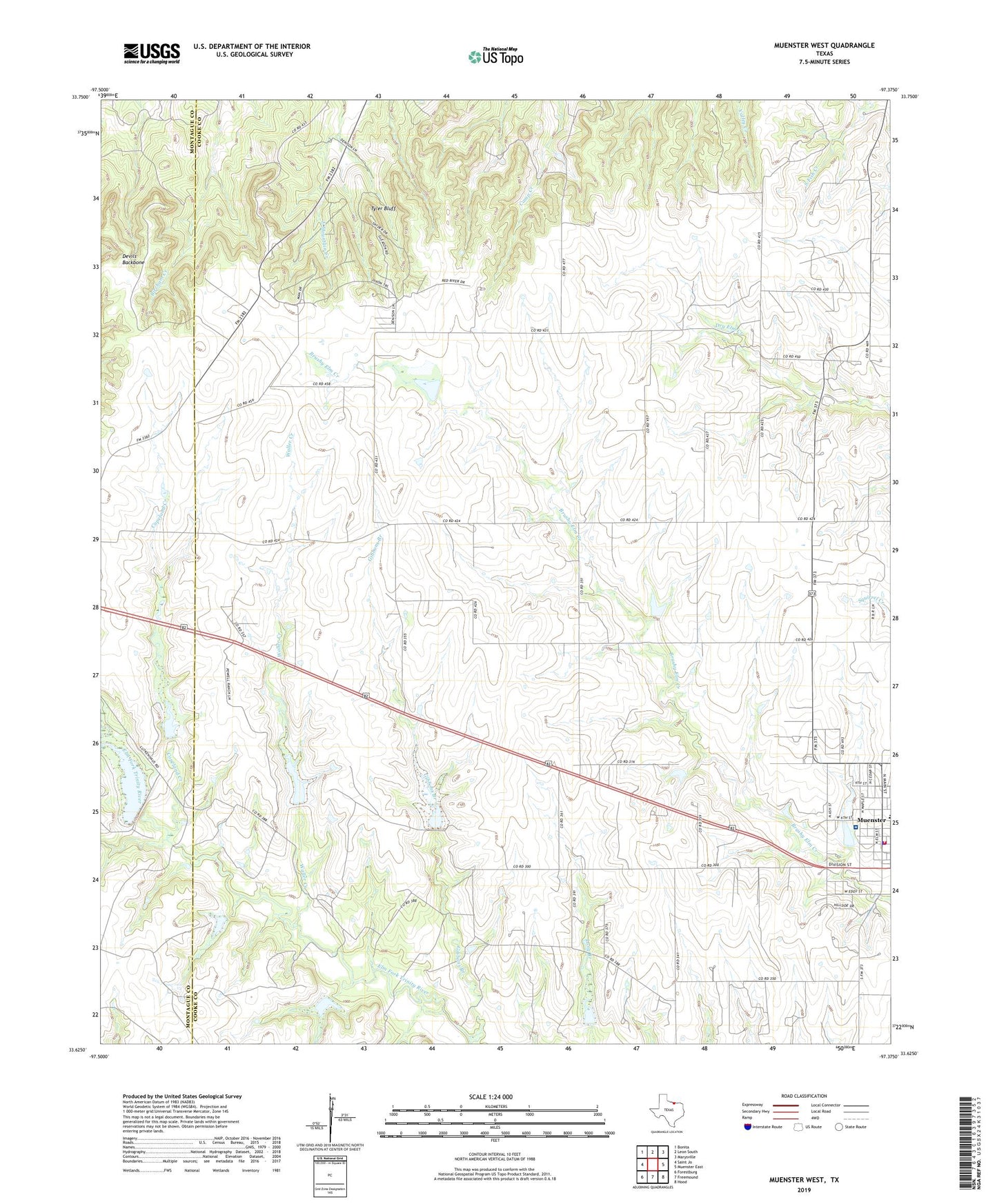
2022 topographic map quadrangle Muenster West in the state of Texas. Scale: 1:24000. Based on the newly updated USGS 7.5' US Topo map series, this map is in the following counties: Cooke, Montague. The map contains contour data, water features, and other items you are used to seeing on USGS maps, but also has updated roads and other features. This is the next generation of topographic maps. Printed on high-quality waterproof paper with UV fade-resistant inks.
Quads adjacent to this one:
West: Saint Jo
Northwest: Bonita
North: Leon South
Northeast: Marysville
East: Muenster East
Southeast: Hood
South: Freemound
Southwest: Forestburg
This map covers the same area as the classic USGS quad with code o33097f4.
Contains the following named places: City of Muenster, Copeland Creek, Devils Backbone, Gibbons Branch, Muenster, Muenster City Hall, Muenster Memorial Hospital, Muenster Police Department, Muenster Post Office, Muenster Volunteer Fire Department, Soil Conservation Service Site 1 Dam, Soil Conservation Service Site 1 Reservoir, Soil Conservation Service Site 19 Dam, Soil Conservation Service Site 19 Reservoir, Soil Conservation Service Site 2 Dam, Soil Conservation Service Site 2 Reservoir, Soil Conservation Service Site 3 Dam, Soil Conservation Service Site 3 Reservoir, Soil Conservation Service Site 4 Dam, Soil Conservation Service Site 4 Reservoir, Soil Conservation Service Site 5 Dam, Soil Conservation Service Site 5 Reservoir, Soil Conservation Service Site 5a Dam, Soil Conservation Service Site 5a Reservoir, Soil Conservation Service Site 5b Dam, Soil Conservation Service Site 5b Reservoir, Soil Conservation Service Site 61cc Dam, Soil Conservation Service Site 61cc Reservoir, Soil Conservation Service Site 6a1 Dam, Soil Conservation Service Site 6a1 Reservoir, Soil Conservation Service Site 6b Dam, Soil Conservation Service Site 6b Reservoir, Soil Conservation Service Site 6e Dam, Soil Conservation Service Site 6e Reservoir, Tyler Bluff, Waller Creek, ZIP Code: 76252