MyTopo
Borden Texas US Topo Map
Couldn't load pickup availability
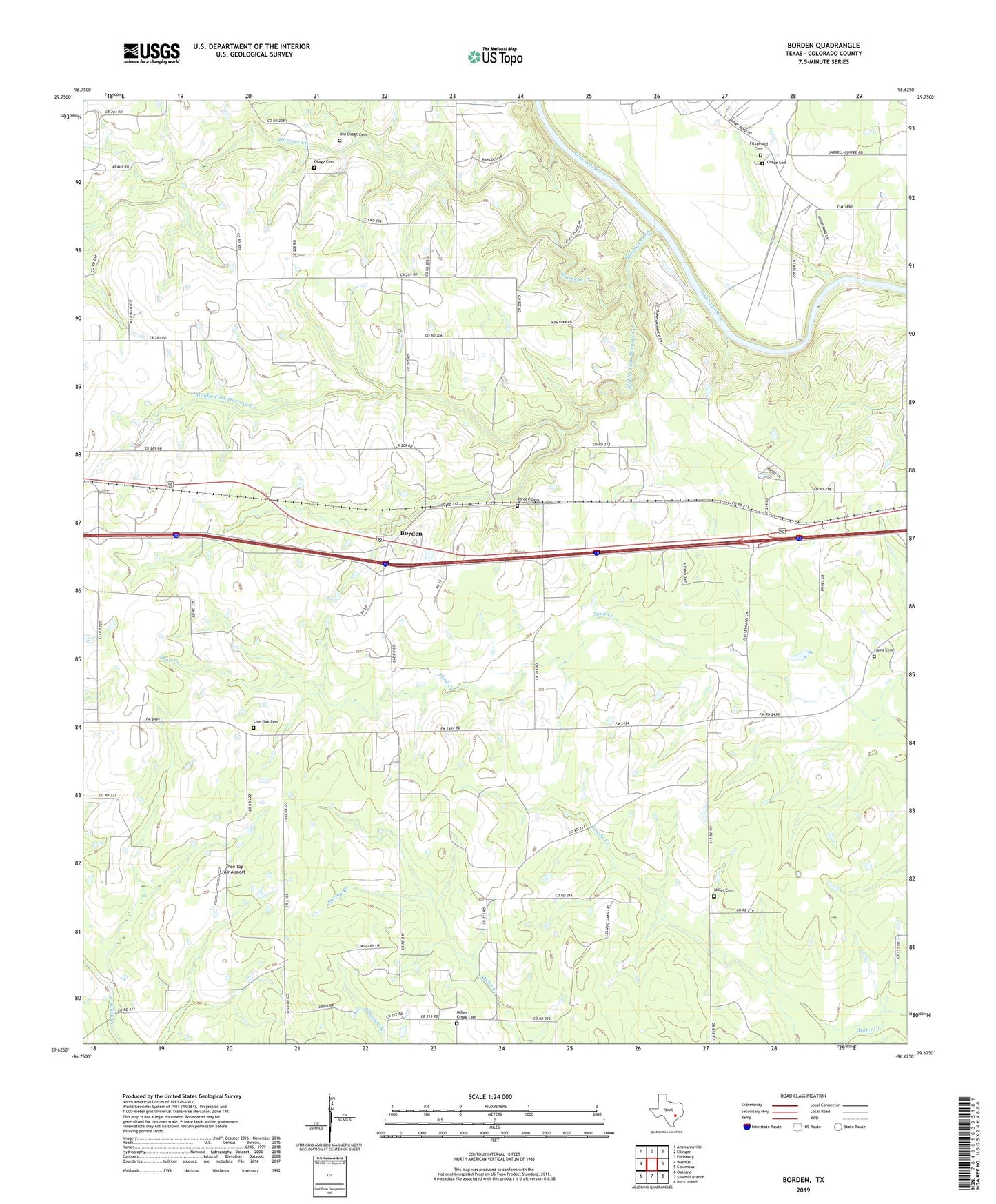
2019 topographic map quadrangle Borden in the state of Texas. Scale: 1:24000. Based on the newly updated USGS 7.5' US Topo map series, this map is in the following counties: Colorado. The map contains contour data, water features, and other items you are used to seeing on USGS maps, but also has updated roads and other features. This is the next generation of topographic maps. Printed on high-quality waterproof paper with UV fade-resistant inks.
Quads adjacent to this one:
West: Weimar
Northwest: Ammannsville
North: Ellinger
Northeast: Frelsburg
East: Columbus
Southeast: Rock Island
South: Sawmill Branch
Southwest: Oakland
Contains the following named places: Borden, Borden Cemetery, Borden-Siding, Fitzgerald Cemetery, Gladys Harrington Library, Good Hope Church, Grace Cemetery, Hamel Oil Field, Harveys Creek, Ijams Cemetery, Live Oak Cemetery, Middle Fork Harveys Creek, Miller Cemetery, Miller Creek Cemetery, Oak Grove School, Old Osage Cemetery, Osage Cemetery, Pleasant Hill Church, Saint Johns Church, Schimelpfenig Library, Shaws Bend, Spring Branch, Tree Top Air, ZIP Code: 78962