MyTopo
Rock Island Texas US Topo Map
Couldn't load pickup availability
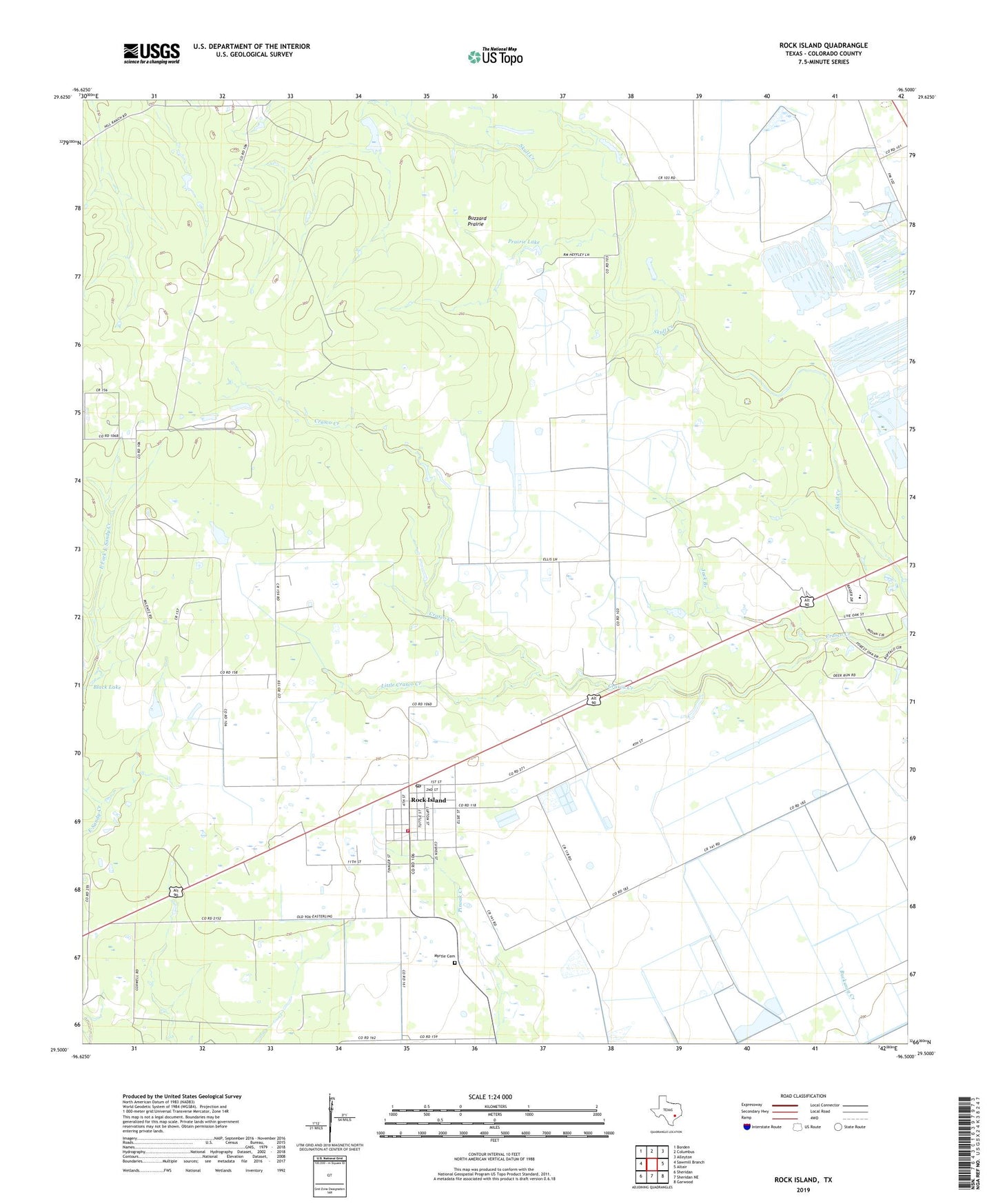
2022 topographic map quadrangle Rock Island in the state of Texas. Scale: 1:24000. Based on the newly updated USGS 7.5' US Topo map series, this map is in the following counties: Colorado. The map contains contour data, water features, and other items you are used to seeing on USGS maps, but also has updated roads and other features. This is the next generation of topographic maps. Printed on high-quality waterproof paper with UV fade-resistant inks.
Quads adjacent to this one:
West: Sawmill Branch
Northwest: Borden
North: Columbus
Northeast: Alleyton
East: Altair
Southeast: Garwood
South: Sheridan NE
Southwest: Sheridan
This map covers the same area as the classic USGS quad with code o29096e5.
Contains the following named places: Black Lake, Buzzard Prairie, Colorado County, Griffin Lake, Jack Branch, Little Crasco Creek, Myrtle Cemetery, Prairie Lake, Rock Island, Rock Island Census Designated Place, Rock Island Post Office, Rock Island Volunteer Fire Department, ZIP Code: 77470