MyTopo
Brashear Texas US Topo Map
Couldn't load pickup availability
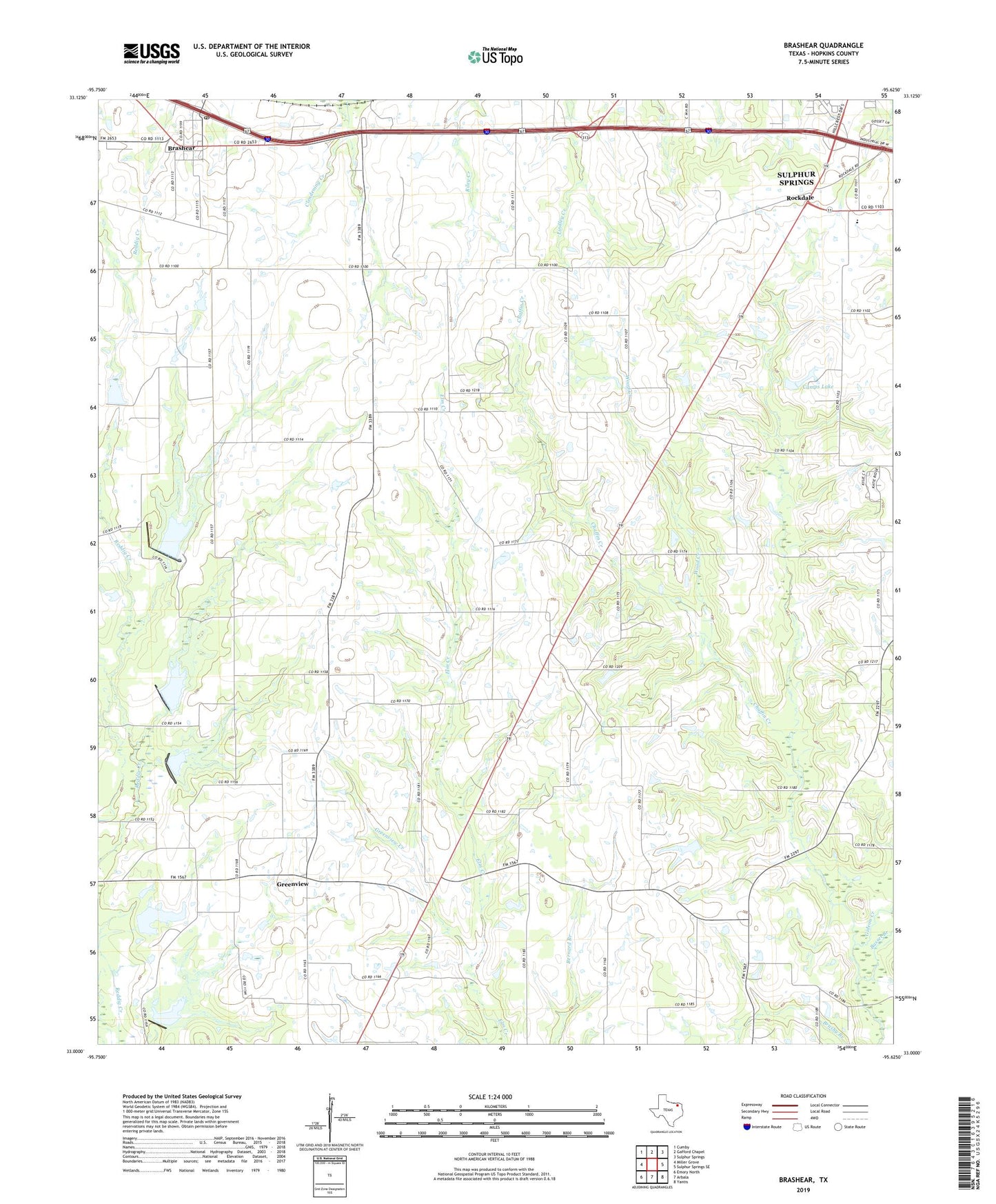
2019 topographic map quadrangle Brashear in the state of Texas. Scale: 1:24000. Based on the newly updated USGS 7.5' US Topo map series, this map is in the following counties: Hopkins. The map contains contour data, water features, and other items you are used to seeing on USGS maps, but also has updated roads and other features. This is the next generation of topographic maps. Printed on high-quality waterproof paper with UV fade-resistant inks.
Quads adjacent to this one:
West: Miller Grove
Northwest: Cumby
North: Gafford Chapel
Northeast: Sulphur Springs
East: Sulphur Springs SE
Southeast: Yantis
South: Arbala
Southwest: Emory North
Contains the following named places: Basset Branch, Brashear, Brashear Post Office, Camps Lake, Chaffin Creek, Dam Number 17, Dam Number 18, Dam Number 19, Dam Number 8, Divide, Gideon Creek, Greenview, Greenview Church, Greenview Creek, Liberty, New Hope Church, Pleasant Hill Church, Rockdale, Rockdale Church, Shirley, Shirley Church, Soil Conservation Service Lake 21, Soil Conservation Service Site 16c Dam, Soil Conservation Service Site 16c Reservoir, Soil Conservation Service Site 17 Dam, Soil Conservation Service Site 17 Reservoir, Soil Conservation Service Site 18 Dam, Soil Conservation Service Site 18 Reservoir, Soil Conservation Service Site 19 Dam, Soil Conservation Service Site 19 Reservoir, Soil Conservation Service Site 21 Dam, Wood Creek, ZIP Code: 75420