MyTopo
Miller Grove Texas US Topo Map
Couldn't load pickup availability
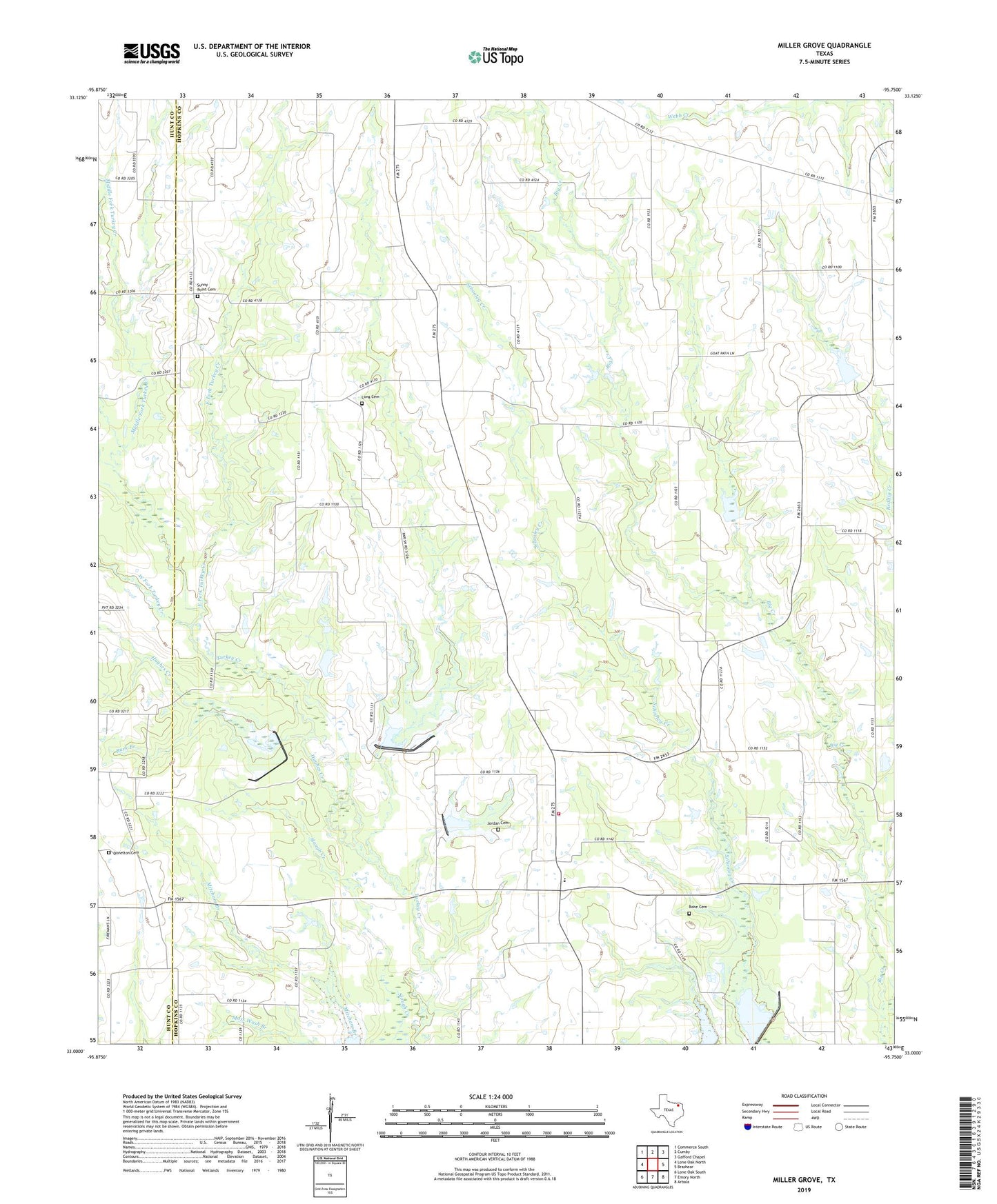
2022 topographic map quadrangle Miller Grove in the state of Texas. Scale: 1:24000. Based on the newly updated USGS 7.5' US Topo map series, this map is in the following counties: Hopkins, Hunt. The map contains contour data, water features, and other items you are used to seeing on USGS maps, but also has updated roads and other features. This is the next generation of topographic maps. Printed on high-quality waterproof paper with UV fade-resistant inks.
Quads adjacent to this one:
West: Lone Oak North
Northwest: Commerce South
North: Cumby
Northeast: Gafford Chapel
East: Brashear
Southeast: Arbala
South: Emory North
Southwest: Lone Oak South
This map covers the same area as the classic USGS quad with code o33095a7.
Contains the following named places: Bone and Proctor Cemetery, Burk Branch, Cedar Creek, Center Point, Cumby Division, Dam Number 12, Dam Number 13, Dam Number 14, Dam Number 28, Donelton Cemetery, Donelton Church, East Fork Turkey Creek, Hughes Creek, Jordan Cemetery, Long Cemetery, Middle Fork Turkey Creek, Miller Grove, Miller Grove Volunteer Fire Department Station 13, Palestine, Schooley Creek, Soil Conservation Service Site 12 Dam, Soil Conservation Service Site 12 Reservoir, Soil Conservation Service Site 13 Dam, Soil Conservation Service Site 13 Reservoir, Soil Conservation Service Site 14 Dam, Soil Conservation Service Site 14 Reservoir, Soil Conservation Service Site 15a Dam, Soil Conservation Service Site 15a Reservoir, Soil Conservation Service Site 16b Dam, Soil Conservation Service Site 16b Reservoir, Soil Conservation Service Site 23 Dam, Soil Conservation Service Site 23 Reservoir, Sunny Point Cemetery, Texas No Name Number 37 Dam, West Fork Turkey Creek, ZIP Code: 75433