MyTopo
Bronte Texas US Topo Map
Couldn't load pickup availability
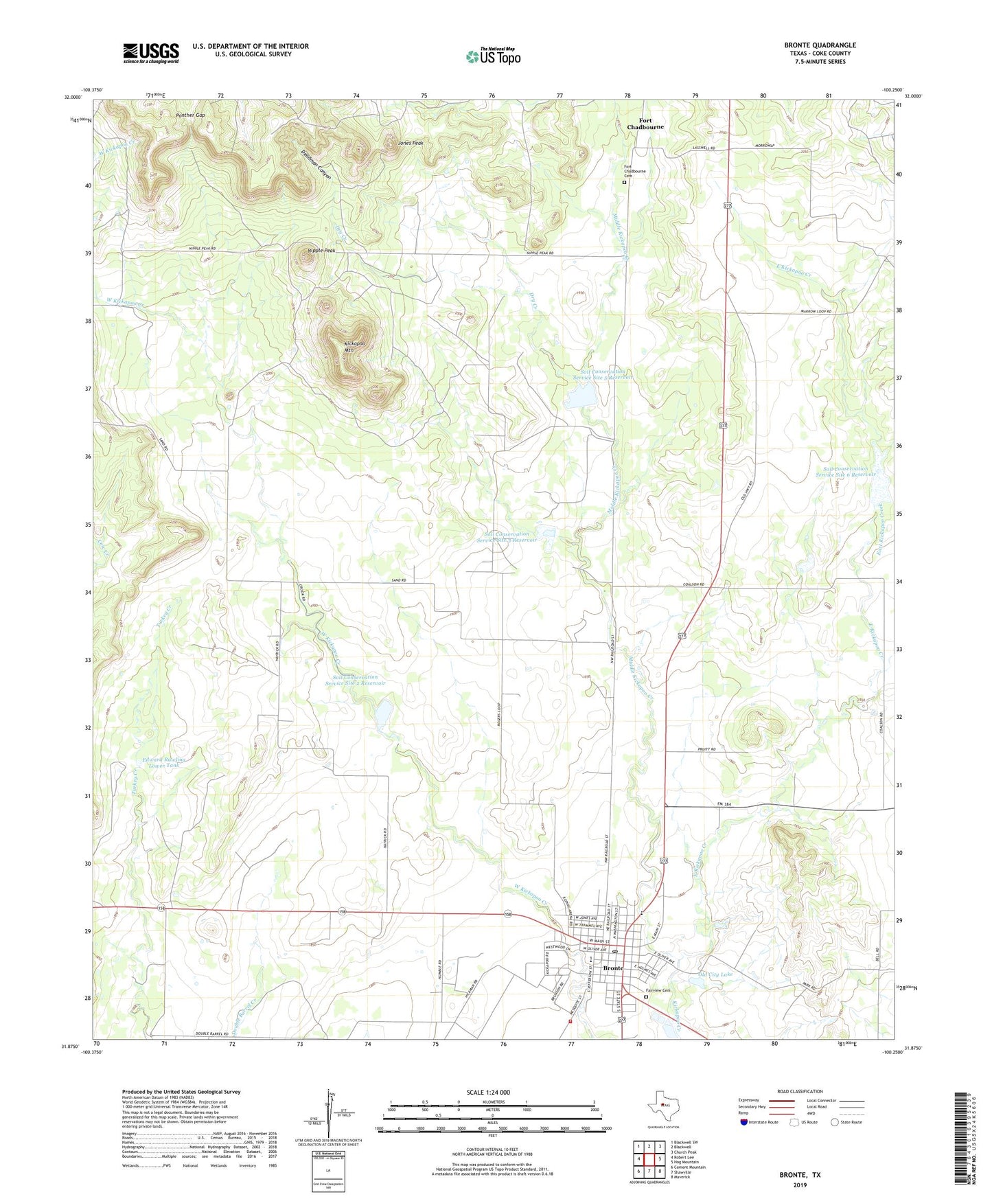
2019 topographic map quadrangle Bronte in the state of Texas. Scale: 1:24000. Based on the newly updated USGS 7.5' US Topo map series, this map is in the following counties: Coke. The map contains contour data, water features, and other items you are used to seeing on USGS maps, but also has updated roads and other features. This is the next generation of topographic maps. Printed on high-quality waterproof paper with UV fade-resistant inks.
Quads adjacent to this one:
West: Robert Lee
Northwest: Blackwell SW
North: Blackwell
Northeast: Church Peak
East: Hog Mountain
Southeast: Maverick
South: Shawville
Southwest: Cement Mountain
Contains the following named places: Bronte, Bronte Church of Christ, Bronte City Hall, Bronte Division, Bronte Elementary School, Bronte High School, Bronte Oil Field, Bronte Post Office, Bronte Volunteer Fire Department, Deadman Canyon, Dry Creek, East Coke County Ambulance Service, East Kickapoo Creek, Edward Rawling Lower Tank, Edward Rawling Lower Tank Dam, Edward Rawling Upper Tank, Edward Rawling Upper Tank Dam, Fairview Cemetery, Fort Chadbourne Cemetery, Jones Peak, Kickapoo Mountain, Middle Kickapoo Creek, Nipple Peak, Old City Lake, Old City Lake Dam, Panther Gap, Rawlings Oil Field, Soil Conservation Service Site 2 Dam, Soil Conservation Service Site 2 Reservoir, Soil Conservation Service Site 3 Dam, Soil Conservation Service Site 3 Reservoir, Soil Conservation Service Site 5 Dam, Soil Conservation Service Site 5 Reservoir, Soil Conservation Service Site 6 Dam, Soil Conservation Service Site 6 Reservoir, Town of Bronte