MyTopo
Robert Lee Texas US Topo Map
Couldn't load pickup availability
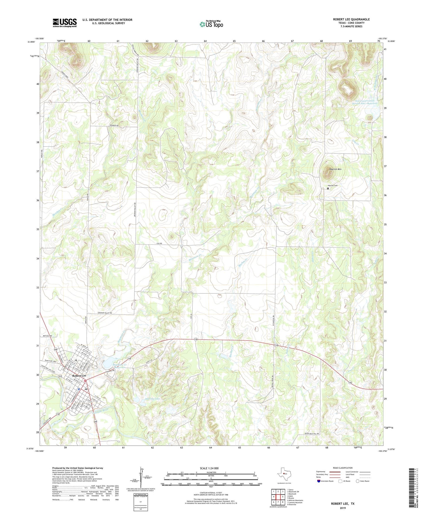
2022 topographic map quadrangle Robert Lee in the state of Texas. Scale: 1:24000. Based on the newly updated USGS 7.5' US Topo map series, this map is in the following counties: Coke. The map contains contour data, water features, and other items you are used to seeing on USGS maps, but also has updated roads and other features. This is the next generation of topographic maps. Printed on high-quality waterproof paper with UV fade-resistant inks.
Quads adjacent to this one:
West: Edith
Northwest: Sanco
North: Blackwell SW
Northeast: Blackwell
East: Bronte
Southeast: Shawville
South: Cement Mountain
Southwest: Millican Mountains
This map covers the same area as the classic USGS quad with code o31100h4.
Contains the following named places: City of Robert Lee, Coke County Constable's Office, Coke County Jail, Coke County Sheriff's Office, Hayrick Cemetery, Hayrick Mountain, Indian Creek Cemetery, McCuthen Oil Field, Messbox Creek, Mountain Creek, Mountain Creek Dam, Mountain Creek Reservoir, Munn Oil Field, Old City Lake, Old City Lake Dam, Robert Lee, Robert Lee Cemetery, Robert Lee City Hall, Robert Lee Hispanic Cemetery, Robert Lee Post Office, Robert Lee Volunteer Fire Department, Soil Conservation Service Site 1 Dam, Soil Conservation Service Site 1 Reservoir, West Coke County Emergency Medical Services