MyTopo
Bryant Ranch Texas US Topo Map
Couldn't load pickup availability
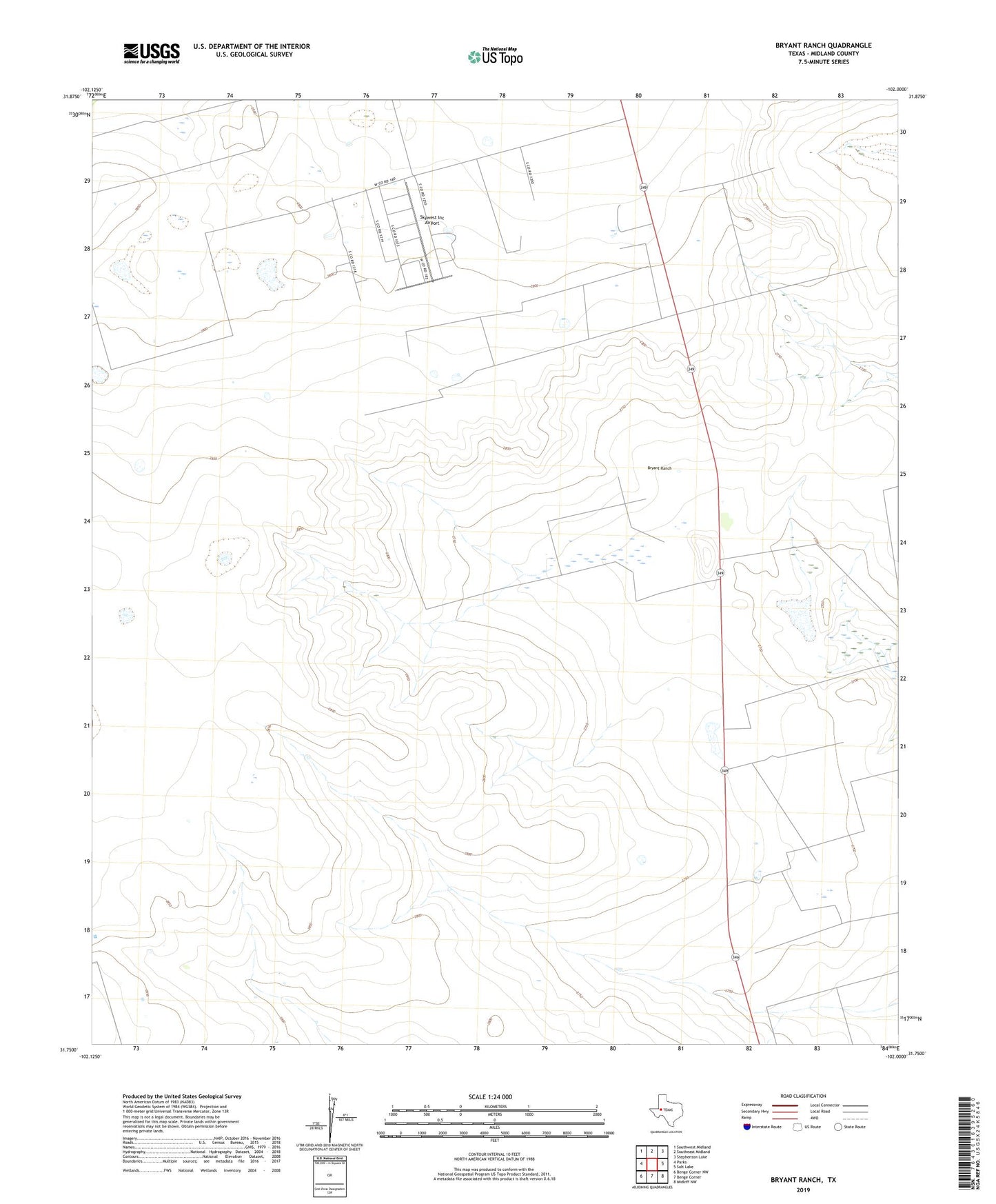
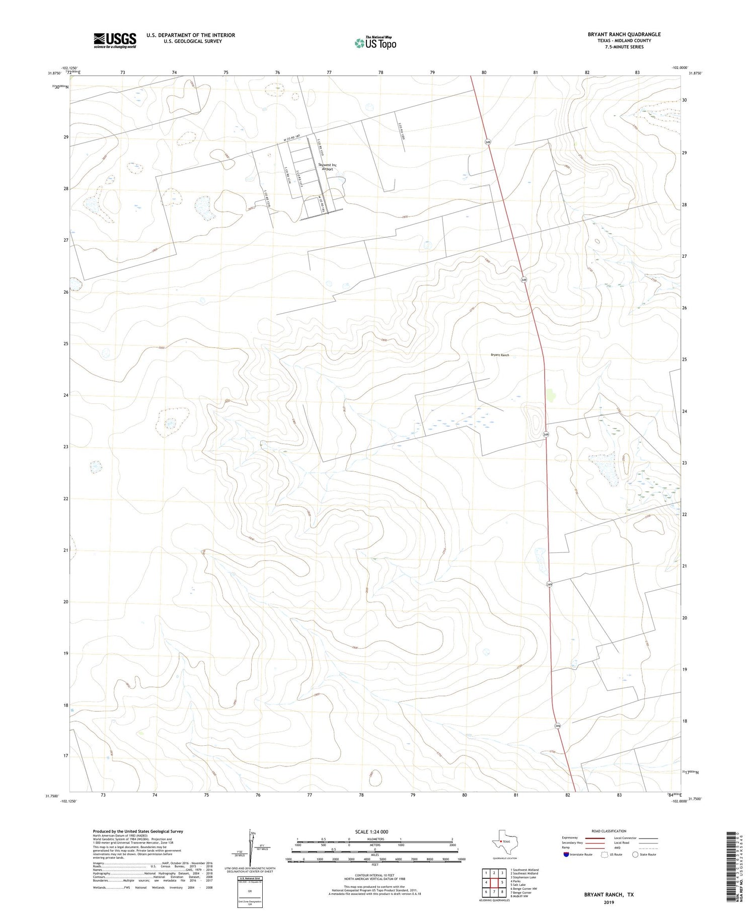
2019 topographic map quadrangle Bryant Ranch in the state of Texas. Scale: 1:24000. Based on the newly updated USGS 7.5' US Topo map series, this map is in the following counties: Midland. The map contains contour data, water features, and other items you are used to seeing on USGS maps, but also has updated roads and other features. This is the next generation of topographic maps. Printed on high-quality waterproof paper with UV fade-resistant inks.
Quads adjacent to this one:
West: Parks
Northwest: Southwest Midland
North: Southeast Midland
Northeast: Stephenson Lake
East: Salt Lake
Southeast: Midkiff NW
South: Benge Corner
Southwest: Benge Corner NW
Contains the following named places: Bryant Ranch, Midland County, Midland South Division, Skywest Inc Airport, Windmill Number Eight, Windmill Number Five, Windmill Number Four, Windmill Number Fourteen, Windmill Number Nine, Windmill Number Nineteen, Windmill Number Seven, Windmill Number Six, Windmill Number Ten, Windmill Number Thirteen, Windmill Number Three, ZIP Code: 79706