MyTopo
Salt Lake Texas US Topo Map
Couldn't load pickup availability
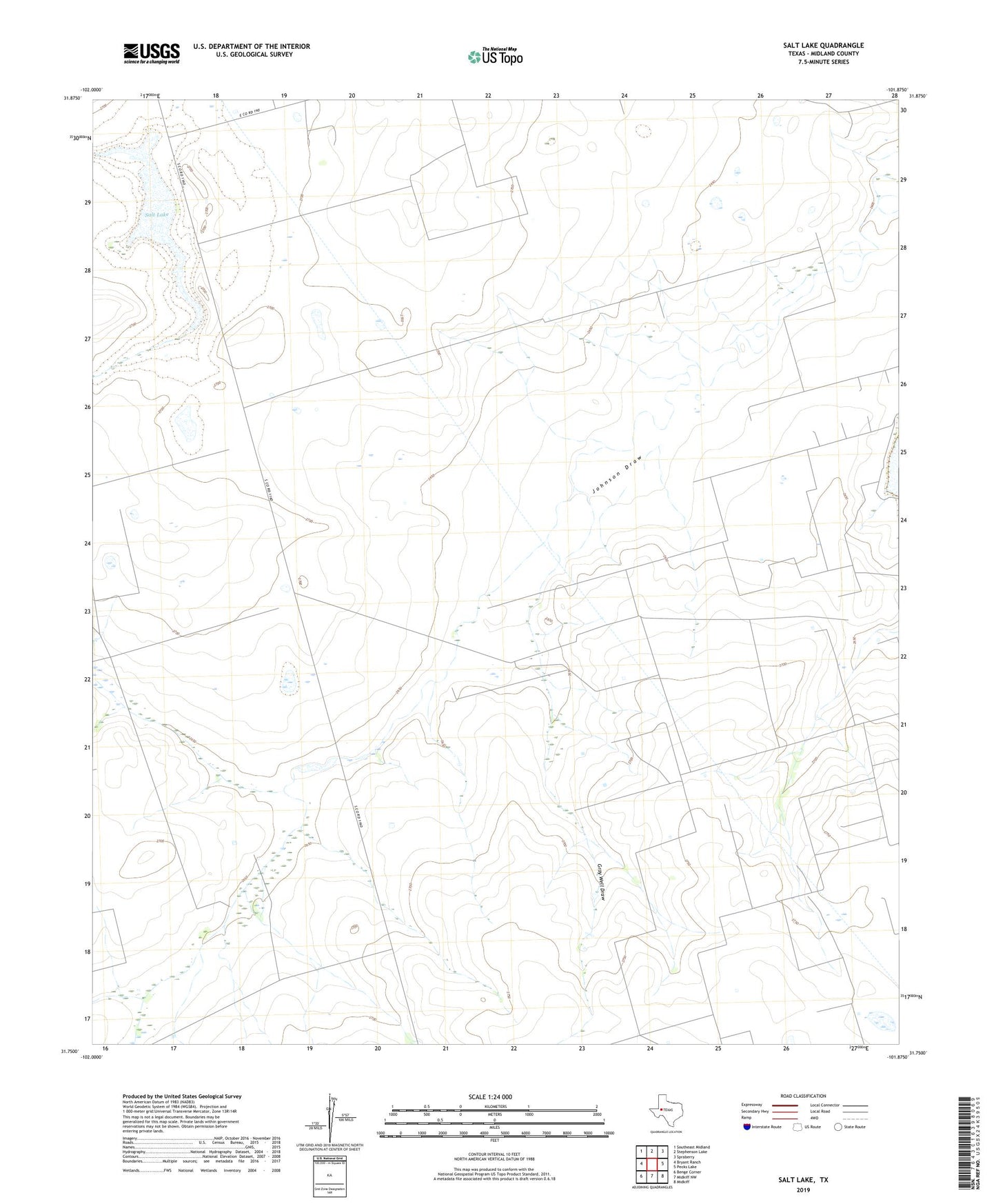
2022 topographic map quadrangle Salt Lake in the state of Texas. Scale: 1:24000. Based on the newly updated USGS 7.5' US Topo map series, this map is in the following counties: Midland. The map contains contour data, water features, and other items you are used to seeing on USGS maps, but also has updated roads and other features. This is the next generation of topographic maps. Printed on high-quality waterproof paper with UV fade-resistant inks.
Quads adjacent to this one:
West: Bryant Ranch
Northwest: Southeast Midland
North: Stephenson Lake
Northeast: Spraberry
East: Pecks Lake
Southeast: Midkiff
South: Midkiff NW
Southwest: Benge Corner
This map covers the same area as the classic USGS quad with code o31101g8.
Contains the following named places: Bull Windmill, Cement Windmill, Crawford Windmill, Fortyfive Windmill, Fortyfour Windmill, Franklin Ranch, Gray Well, Gray Well Draw, Hutt Ranch, Lake Windmill, Nineteen Windmill, Oil Well Windmill, Redtop Windmill, Reynolds Windmill, Salt Lake, South Witcher Windmill, Windmill Number One, Windmill Number Twelve, Winkleman Windmill, Wysong Windmill, Youngblood Windmill