MyTopo
Parks Texas US Topo Map
Couldn't load pickup availability
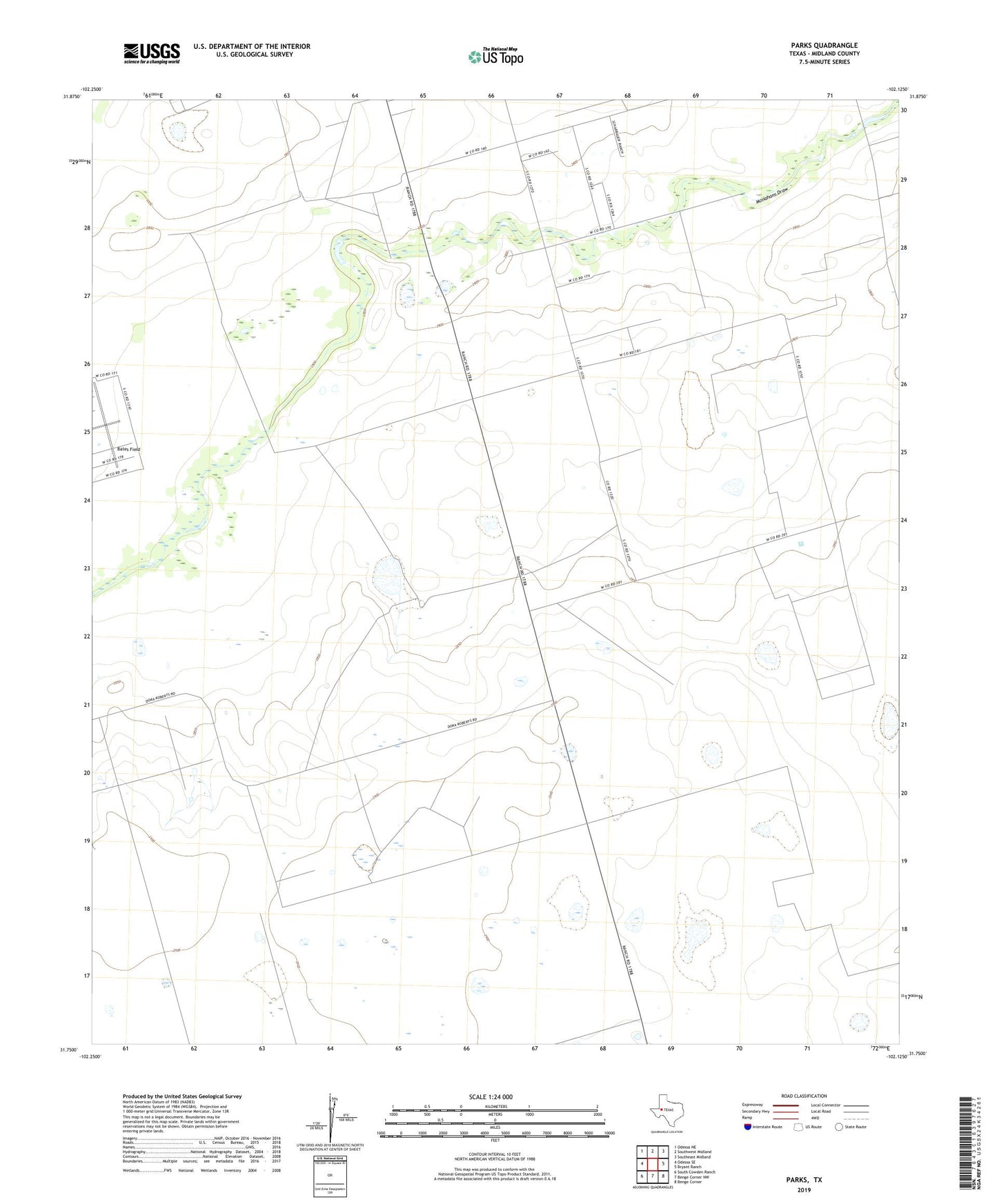
2022 topographic map quadrangle Parks in the state of Texas. Scale: 1:24000. Based on the newly updated USGS 7.5' US Topo map series, this map is in the following counties: Midland. The map contains contour data, water features, and other items you are used to seeing on USGS maps, but also has updated roads and other features. This is the next generation of topographic maps. Printed on high-quality waterproof paper with UV fade-resistant inks.
Quads adjacent to this one:
West: Odessa SE
Northwest: Odessa NE
North: Southwest Midland
Northeast: Southeast Midland
East: Bryant Ranch
Southeast: Benge Corner
South: Benge Corner NW
Southwest: South Cowden Ranch
This map covers the same area as the classic USGS quad with code o31102g2.
Contains the following named places: Bates Field, Boxcar Windmill, Camp Pasture Windmill, Chuck Houston Windmill, Corner Windmill, East Hensley Windmill, East Windmill, Hensley Windmill, Hi Estes Windmill, KODM-FM (Odessa), Lake Windmill, Little Star Windmill, Montgomery Windmill, North Benedict Windmill, North Estes Windmill, North Windmill, Parks Oil Field, Pliska Aircraft Museum, South Benedict Windmill, South Estes Windmill, Two Section Windmill, Windmill in the Flat, Windmill on the Hill