MyTopo
Bryson Texas US Topo Map
Couldn't load pickup availability
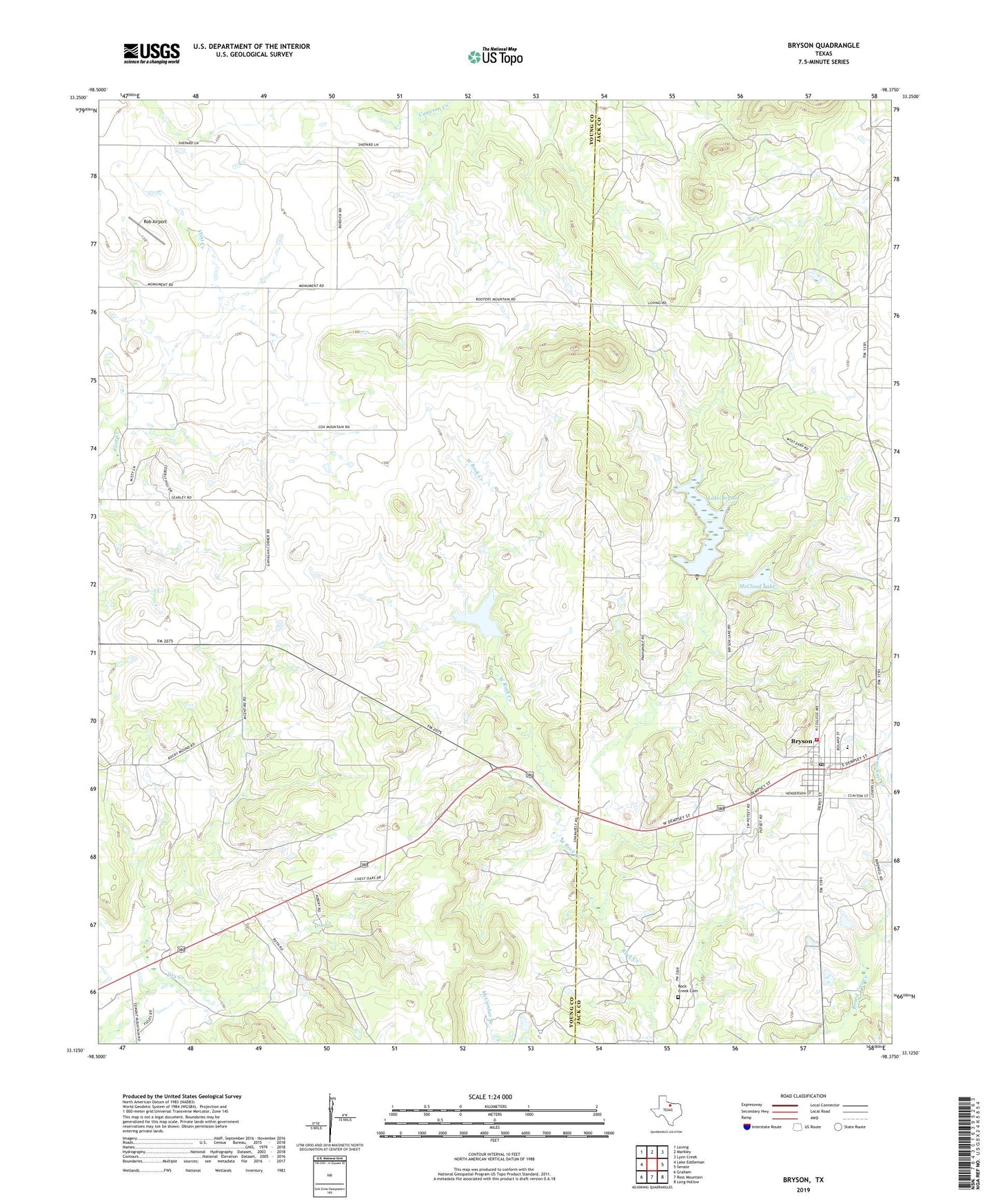
2019 topographic map quadrangle Bryson in the state of Texas. Scale: 1:24000. Based on the newly updated USGS 7.5' US Topo map series, this map is in the following counties: Young, Jack. The map contains contour data, water features, and other items you are used to seeing on USGS maps, but also has updated roads and other features. This is the next generation of topographic maps. Printed on high-quality waterproof paper with UV fade-resistant inks.
Quads adjacent to this one:
West: Lake Eddleman
Northwest: Loving
North: Markley
Northeast: Lynn Creek
East: Senate
Southeast: Long Hollow
South: Ross Mountain
Southwest: Graham
Contains the following named places: Bryson, Bryson City Hall, Bryson Lake Dam, Bryson Post Office, Bryson Volunteer Emergency Medical Service, Bryson Volunteer Fire Department, Carmichael Creek, City of Bryson, Cowboy Field, Flint Creek Mission, Knox Oil Field, Lake Bryson, Lake Bryson Dam, McCloud Lake, McCloud Lake Dam, Rob Airport, Rock Creek Cemetery, West Rock Creek, ZIP Code: 76427