MyTopo
Senate Texas US Topo Map
Couldn't load pickup availability
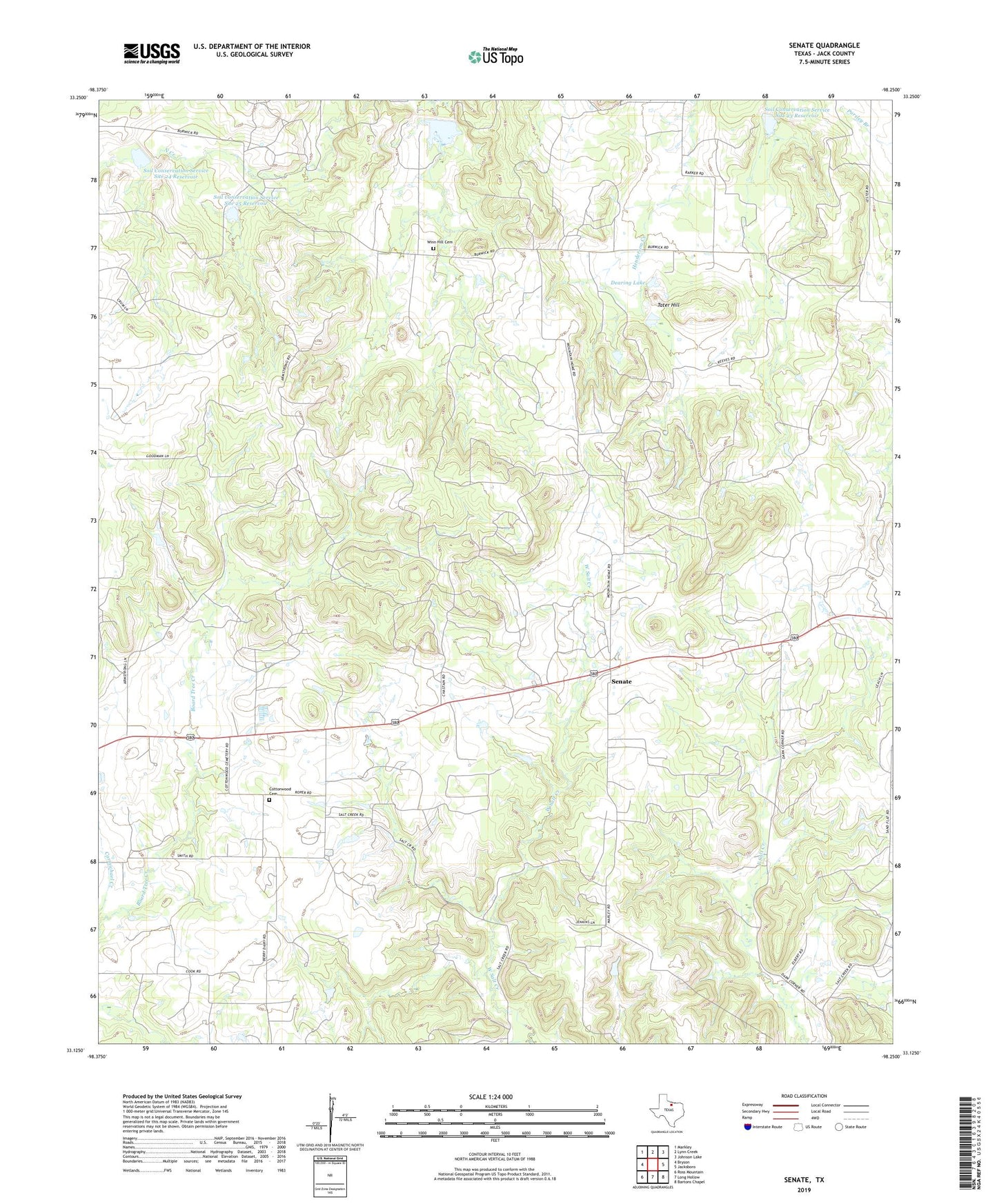
2022 topographic map quadrangle Senate in the state of Texas. Scale: 1:24000. Based on the newly updated USGS 7.5' US Topo map series, this map is in the following counties: Jack. The map contains contour data, water features, and other items you are used to seeing on USGS maps, but also has updated roads and other features. This is the next generation of topographic maps. Printed on high-quality waterproof paper with UV fade-resistant inks.
Quads adjacent to this one:
West: Bryson
Northwest: Markley
North: Lynn Creek
Northeast: Johnson Lake
East: Jacksboro
Southeast: Bartons Chapel
South: Long Hollow
Southwest: Ross Mountain
This map covers the same area as the classic USGS quad with code o33098b3.
Contains the following named places: Bethany Church, Bob Town, Bryson Division, Bryson Oil Field, Cottonwood Cemetery, Dearing Lake, Dearing Lake Dam, Mountain Home Missionary Church, Rhodes Lake, Rhodes Lake Dam, Senate, Soil Conservation Service Site 22 Dam, Soil Conservation Service Site 22 Reservoir, Soil Conservation Service Site 23 Dam, Soil Conservation Service Site 23 Reservoir, Soil Conservation Service Site 24 Dam, Soil Conservation Service Site 24 Reservoir, Soil Conservation Service Site 25 Dam, Soil Conservation Service Site 25 Reservoir, Soil Conservation Service Site 28a Dam, Soil Conservation Service Site 28a Reservoir, Tater Hill, Winn Hill Cemetery