MyTopo
Long Hollow Texas US Topo Map
Couldn't load pickup availability
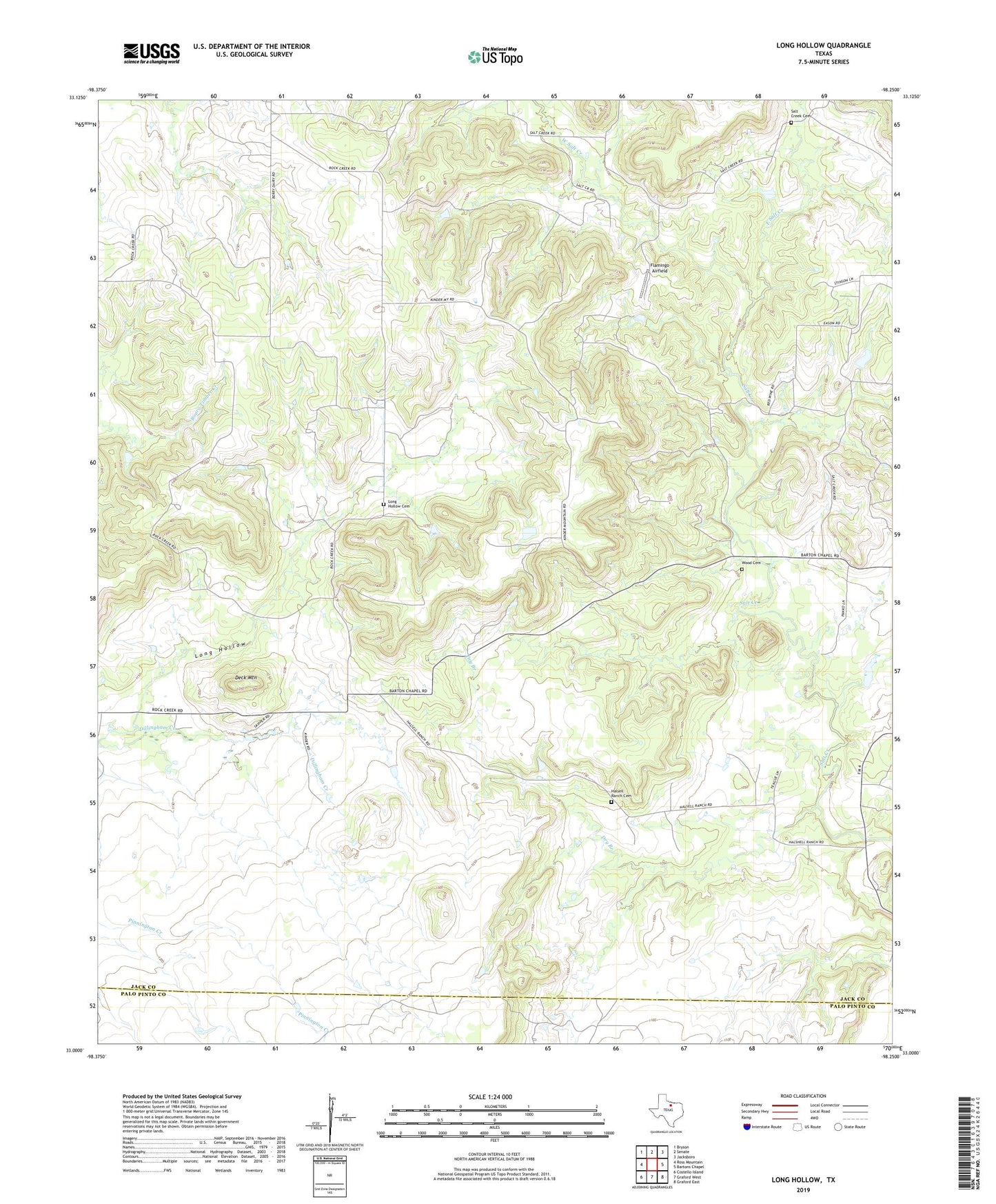
2022 topographic map quadrangle Long Hollow in the state of Texas. Scale: 1:24000. Based on the newly updated USGS 7.5' US Topo map series, this map is in the following counties: Jack, Palo Pinto. The map contains contour data, water features, and other items you are used to seeing on USGS maps, but also has updated roads and other features. This is the next generation of topographic maps. Printed on high-quality waterproof paper with UV fade-resistant inks.
Quads adjacent to this one:
West: Ross Mountain
Northwest: Bryson
North: Senate
Northeast: Jacksboro
East: Bartons Chapel
Southeast: Graford East
South: Graford West
Southwest: Costello Island
This map covers the same area as the classic USGS quad with code o33098a3.
Contains the following named places: Barrow Grace Lake, Barrow Grace Lake Dam, Deck Mountain, Dry Branch, East Salt Creek, Flamingo Airfield, Halsell Ranch Cemetery, Long Hollow, Long Hollow Cemetery, Salt Creek, Salt Creek Cemetery, West Salt Creek, Wood Cemetery