MyTopo
Lynn Creek Texas US Topo Map
Couldn't load pickup availability
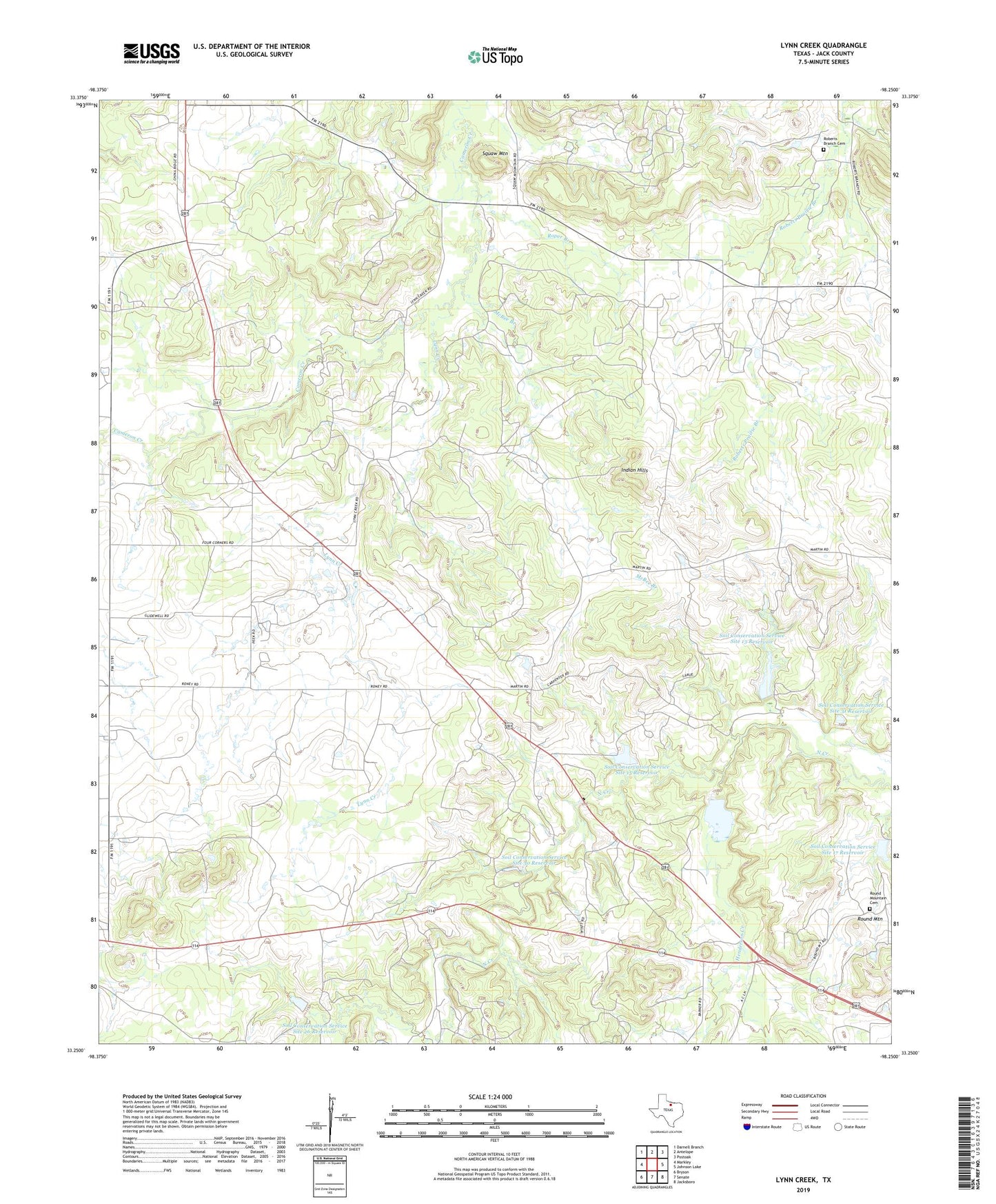
2023 topographic map quadrangle Lynn Creek in the state of Texas. Scale: 1:24000. Based on the newly updated USGS 7.5' US Topo map series, this map is in the following counties: Jack. The map contains contour data, water features, and other items you are used to seeing on USGS maps, but also has updated roads and other features. This is the next generation of topographic maps. Printed on high-quality waterproof paper with UV fade-resistant inks.
Quads adjacent to this one:
West: Markley
Northwest: Darnell Branch
North: Antelope
Northeast: Postoak
East: Johnson Lake
Southeast: Jacksboro
South: Senate
Southwest: Bryson
This map covers the same area as the classic USGS quad with code o33098c3.
Contains the following named places: Ellis Oil Field, Henderson Creek, Indian Hills, Lynn Creek, Lynn Creek Chapel, Martin Lake, Martin Lake Dam, McBee Branch, McDonald Oil Field, Roberts Branch Cemetery, Roper Branch, Round Mountain, Round Mountain Cemetery, Soil Conservation Service Site 13 Dam, Soil Conservation Service Site 13 Reservoir, Soil Conservation Service Site 14 Dam, Soil Conservation Service Site 14 Reservoir, Soil Conservation Service Site 15 Dam, Soil Conservation Service Site 15 Reservoir, Soil Conservation Service Site 16 Dam, Soil Conservation Service Site 16 Reservoir, Soil Conservation Service Site 17 Dam, Soil Conservation Service Site 17 Reservoir, Soil Conservation Service Site 26 Dam, Soil Conservation Service Site 26 Reservoir, Soil Conservation Service Site 30 Dam, Soil Conservation Service Site 30 Reservoir, Soil Conservation Service Site 31 Dam, Soil Conservation Service Site 31 Reservoir, Squaw Mountain