
MyTopo
Buffalo Texas US Topo Map
Couldn't load pickup availability
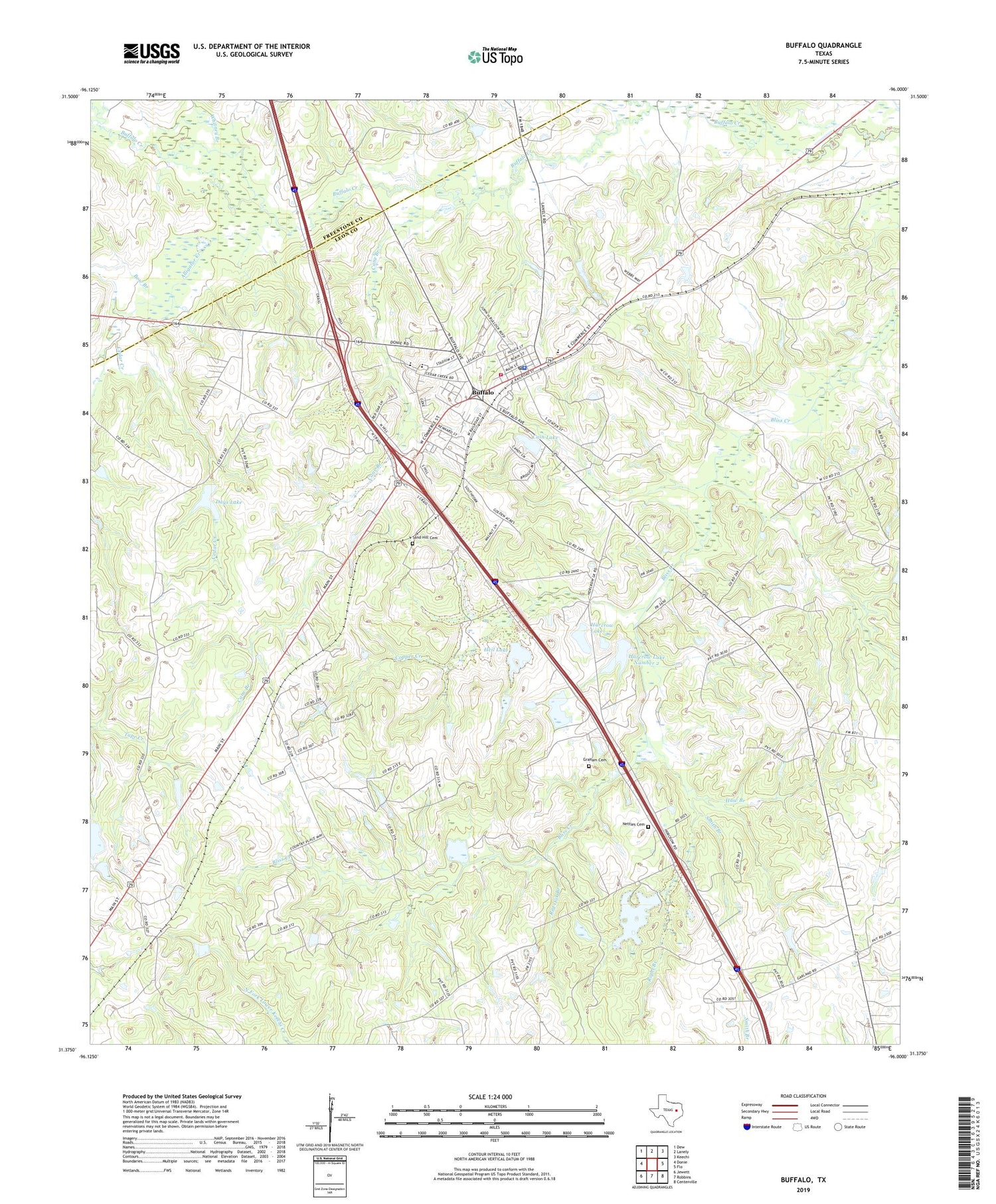
2019 topographic map quadrangle Buffalo in the state of Texas. Scale: 1:24000. Based on the newly updated USGS 7.5' US Topo map series, this map is in the following counties: Leon, Freestone. The map contains contour data, water features, and other items you are used to seeing on USGS maps, but also has updated roads and other features. This is the next generation of topographic maps. Printed on high-quality waterproof paper with UV fade-resistant inks.
Quads adjacent to this one:
West: Donie
Northwest: Dew
North: Lanely
Northeast: Keechi
East: Flo
Southeast: Centerville
South: Robbins
Southwest: Jewett
Contains the following named places: Alligator Creek, Bennett School, Bow Branch, Browns Creek, Buffalo, Buffalo City Hall, Buffalo Division, Buffalo Police Department, Buffalo Post Office, Buffalo Volunteer Fire Department, Cain Lake, Cain Lake Dam, Cane Branch, Cedar Creek, Cedar Creek Church, Cedar Grove Church, City of Buffalo, Copper Creek, Davis Chapel, Days Lake, Graham Cemetery, Harcrow Dam Number 1, Harcrow Lake, Harcrow Lake Number 2, Harcrow Lake Number 2 Dam, Haw Branch, Heil Lake, Heil Lake Dam, Nettles Cemetery, Raines Dam, Red Oak Branch, Red Oak Lake, Rena Branch, Right Branch, Russell Church, Sand Hill Cemetery, Smith Branch, Whitaker Dam, Whitney Branch, ZIP Code: 75831


