MyTopo
Bullard Texas US Topo Map
Couldn't load pickup availability
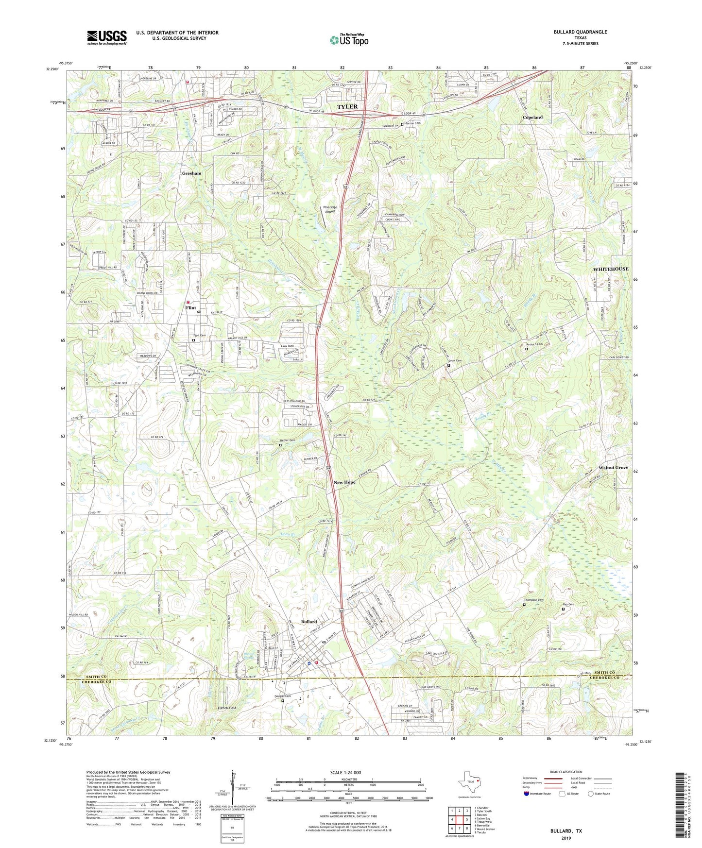
2019 topographic map quadrangle Bullard in the state of Texas. Scale: 1:24000. Based on the newly updated USGS 7.5' US Topo map series, this map is in the following counties: Smith, Cherokee. The map contains contour data, water features, and other items you are used to seeing on USGS maps, but also has updated roads and other features. This is the next generation of topographic maps. Printed on high-quality waterproof paper with UV fade-resistant inks.
Quads adjacent to this one:
West: Saline Bay
Northwest: Chandler
North: Tyler South
Northeast: Bascom
East: Troup West
Southeast: Tecula
South: Mount Selman
Southwest: Berryville
Contains the following named places: Antioch, Antioch Cemetery, Antioch Church, Barron Cemetery, Bishop Church, Bullard, Bullard City Hall, Bullard Fire Department Station 1, Bullard Police Department, Bullard Post Office, Copeland, Crow Cemetery, Dean Branch, Douglas Cemetery, East Texas Guidance and Achievement Center, Flint, Flint - Gresham Fire Department Station 2, Flint - Gresham Volunteer Fire Department Station 1, Flint Cemetery, Flint Post Office, French Field, Grace Chapel Assembly of God Church, Gresham, Henshaw Creek, Lee Spring, Lee Spring Church, Mount Elm Church, Mount Nebo Church, Mount Zion Church, Nazarene Parsonage Flint Church, New Bethel Church, New Hope, Owens Elementary School, Patriots Church, Pineridge Airport, Rather Cemetery, Ray Cemetery, Rhome Spring, Roddy Branch, Shackleford Creek, Thompson Cemetery, Town of Bullard, Walnut Grove, Whitehouse Church, Whitehouse Church of God in Christ, ZIP Code: 75703