MyTopo
Mount Selman Texas US Topo Map
Couldn't load pickup availability
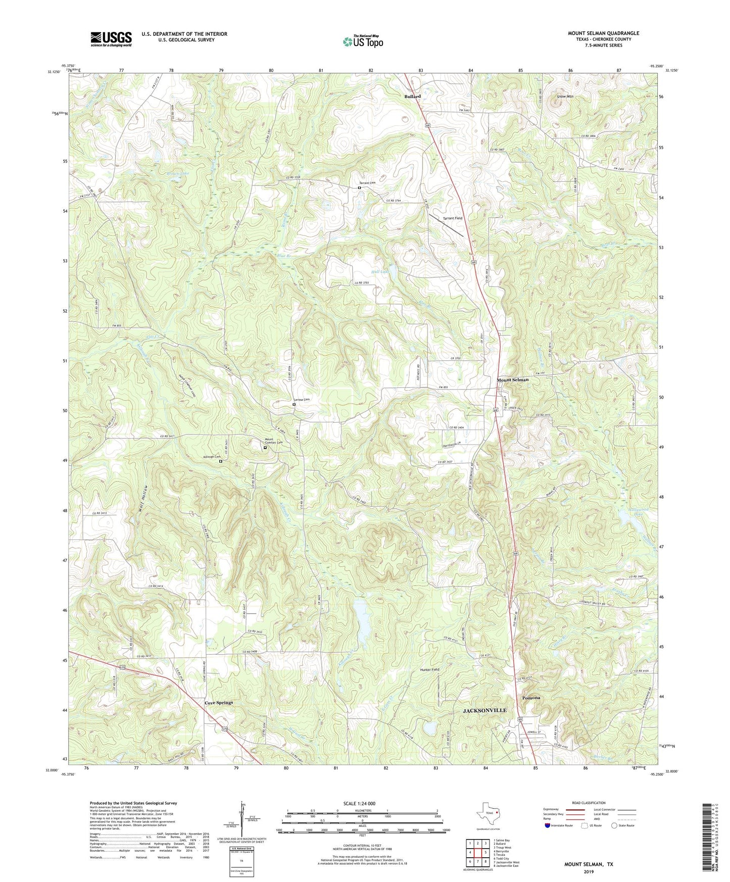
2022 topographic map quadrangle Mount Selman in the state of Texas. Scale: 1:24000. Based on the newly updated USGS 7.5' US Topo map series, this map is in the following counties: Cherokee. The map contains contour data, water features, and other items you are used to seeing on USGS maps, but also has updated roads and other features. This is the next generation of topographic maps. Printed on high-quality waterproof paper with UV fade-resistant inks.
Quads adjacent to this one:
West: Berryville
Northwest: Saline Bay
North: Bullard
Northeast: Troup West
East: Tecula
Southeast: Jacksonville East
South: Jacksonville West
Southwest: Todd City
This map covers the same area as the classic USGS quad with code o32095a3.
Contains the following named places: Blue Branch, Brown Lake, Cove Springs, Crysup Lake, Crysup Lake Dam, Hall Lake, Hall Lake Dam, Hollywood Lake, Hollywood Lake Dam, Hunter Field, KBJS-FM (Jacksonville), KETK-TV (Jacksonville), Killough Cemetery, Killough Creek, KOOI-FM (Jacksonville), Larissa, Larissa Cemetery, Loves Lookout Park, Mount Comfort Cemetery, Mount Nevelton Church, Mount Selman, Mount Selman Division, Mount Selman Speed Bowl, Pierson Branch, Pomona, Rome Branch, Snow Mountain, Tarrant Cemetery, Tarrant Field, Wolf Hollow, ZIP Code: 75757