MyTopo
Saline Bay Texas US Topo Map
Couldn't load pickup availability
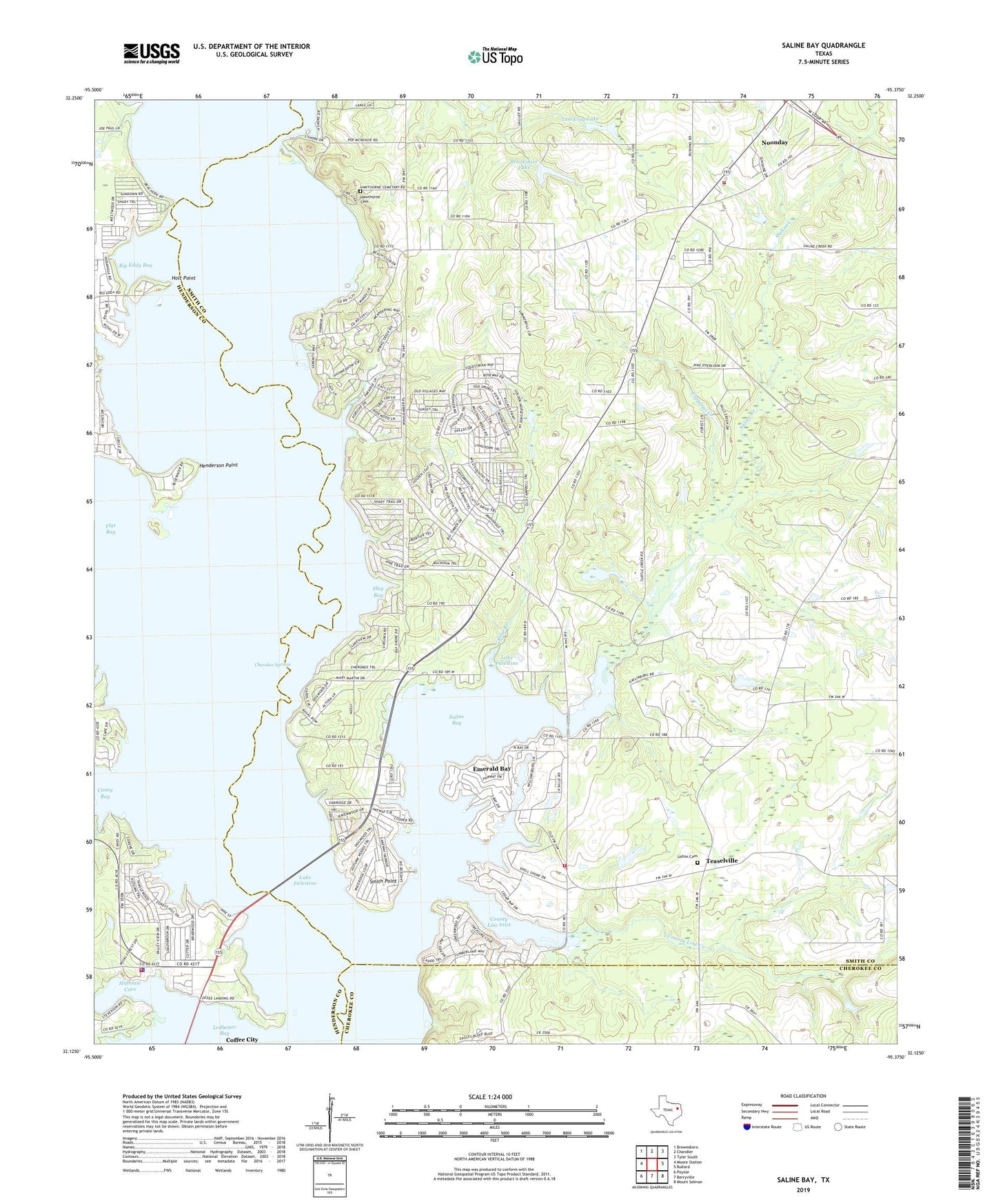
2022 topographic map quadrangle Saline Bay in the state of Texas. Scale: 1:24000. Based on the newly updated USGS 7.5' US Topo map series, this map is in the following counties: Smith, Henderson, Cherokee. The map contains contour data, water features, and other items you are used to seeing on USGS maps, but also has updated roads and other features. This is the next generation of topographic maps. Printed on high-quality waterproof paper with UV fade-resistant inks.
Quads adjacent to this one:
West: Moore Station
Northwest: Brownsboro
North: Chandler
Northeast: Tyler South
East: Bullard
Southeast: Mount Selman
South: Berryville
Southwest: Poynor
This map covers the same area as the classic USGS quad with code o32095b4.
Contains the following named places: Bethlehem Church, Big Eddy Bay, Brookshire Lake, Brookshire Lake Dam, Bullard Division, Caney Bay, Caney Creek, Cherokee Springs, City of Noonday, Coffee City Fire Department, Coffee City Hall, Coffee City Police Department, Colonel John Dewberry House, Copperas Creek, County Line Church, County Line Creek, County Line Inlet, Dogwood City, Emerald Bay Airport, Emerald Bay Census Designated Place, Flag Bay, Flat Bay, Flat Creek, Forest Grove Baptist Church, Gentry Temple Church of God and Christ, Hawthorne Cemetery, Henderson Point, Highsaw Cove, Holt Point, Lake Palestine, Loftin Cemetery, Noonday, Noonday City Hall, Noonday Volunteer Fire Department, Pine Trail Estates, Rose Branch, Saline Bay, Saline Creek, Smith Point, Teaselville, Tom Clay Lake, Tom Clay Lake Dam, Town of Coffee City, Tyler Intake Tower, ZIP Code: 75762