MyTopo
Carmine Texas US Topo Map
Couldn't load pickup availability
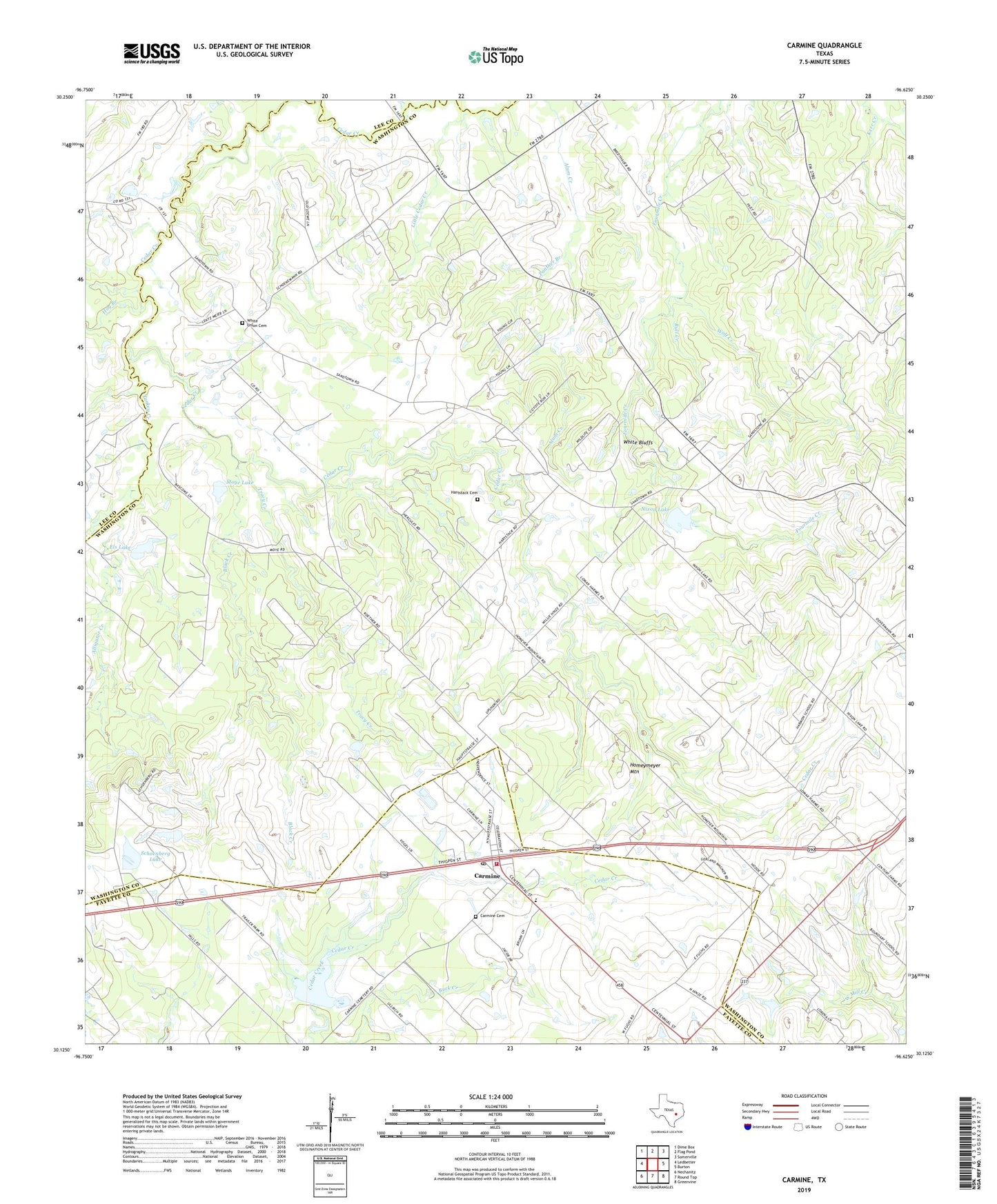
2019 topographic map quadrangle Carmine in the state of Texas. Scale: 1:24000. Based on the newly updated USGS 7.5' US Topo map series, this map is in the following counties: Washington, Fayette, Lee. The map contains contour data, water features, and other items you are used to seeing on USGS maps, but also has updated roads and other features. This is the next generation of topographic maps. Printed on high-quality waterproof paper with UV fade-resistant inks.
Quads adjacent to this one:
West: Ledbetter
Northwest: Dime Box
North: Flag Pond
Northeast: Somerville
East: Burton
Southeast: Greenvine
South: Round Top
Southwest: Nechanitz
Contains the following named places: Alligator Creek, Black Creek, Bull Creek, Carmine, Carmine Cemetery, Carmine City Hall, Carmine High School, Carmine Post Office, Carmine Volunteer Fire Department, City of Carmine, Els Lake, Els Lake Dam, Flood Prevention Dam Number 7, Hartstack Cemetery, Hog Branch, Homeymeyer Mountain, Independent Church, La Bahia, Little Cedar Creek, Moye Lake, Moye Lake Dam, Nixon Lake, Nixon Lake Dam, Panther Branch, Pilgrims Rest Church, Saint Johns Church, Saint Matthew Missionary Church, Schoenberg Lake, Soil Conservation Service Site 7 Dam, Soil Conservation Service Site 7 Reservoir, Tracy Creek, Turkey Creek, White Bluffs, White Union Cemetery, Wolf Creek, ZIP Code: 78932