MyTopo
Greenvine Texas US Topo Map
Couldn't load pickup availability
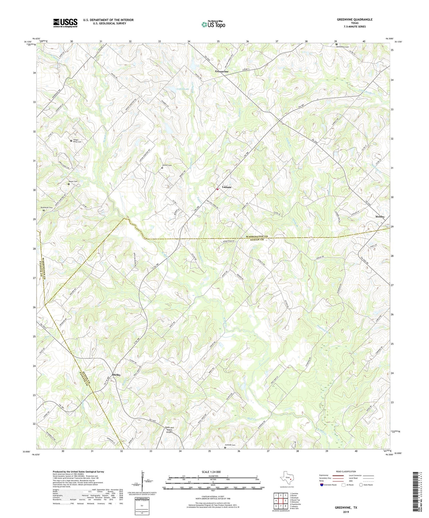
2022 topographic map quadrangle Greenvine in the state of Texas. Scale: 1:24000. Based on the newly updated USGS 7.5' US Topo map series, this map is in the following counties: Washington, Austin, Fayette. The map contains contour data, water features, and other items you are used to seeing on USGS maps, but also has updated roads and other features. This is the next generation of topographic maps. Printed on high-quality waterproof paper with UV fade-resistant inks.
Quads adjacent to this one:
West: Round Top
Northwest: Carmine
North: Burton
Northeast: Brenham
East: Welcome
Southeast: New Ulm
South: Industry
Southwest: Fayetteville
This map covers the same area as the classic USGS quad with code o30096a5.
Contains the following named places: Bethlehem Cemetery, Brushy Creek, Burkhardt Cemetery, Camp Creek, Greenvine, Harmonie Park, Historical Marker, Jaeger-Witte Cemetery, Latium, Latium Cemetery, Loftin Lake, Loftin Lake Dam, Mayer Cemetery, Pond Creek, Rabb and Nobra Airport, Sachse Public Library, Sandy Branch, Schmid Cemetery, Shelby, Skull Creek, Sunnyvale Public Library, Wesley, Witte-Schmid House