MyTopo
Nechanitz Texas US Topo Map
Couldn't load pickup availability
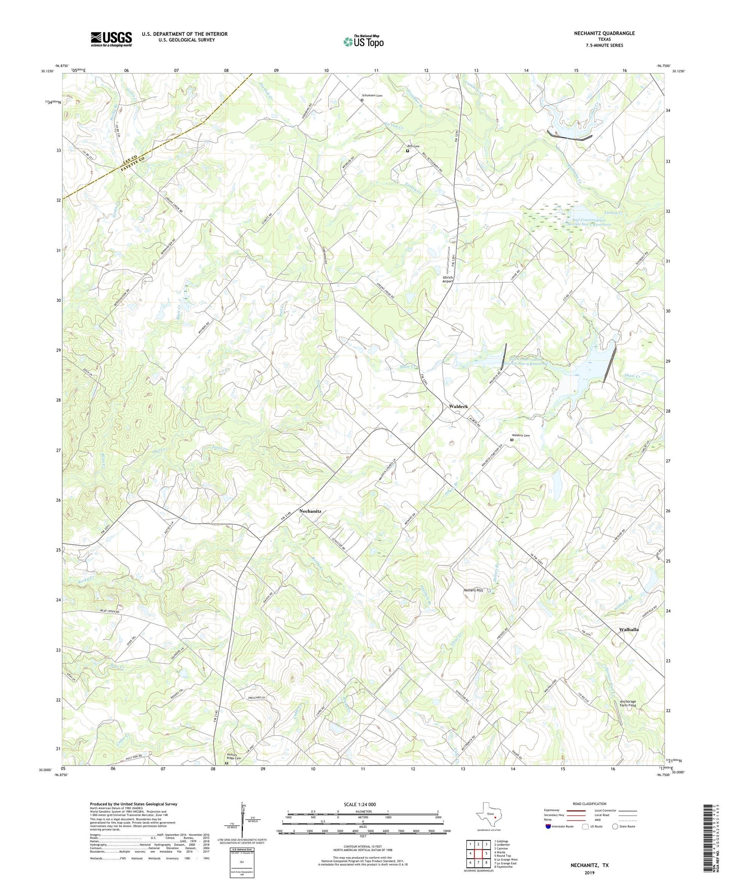
2022 topographic map quadrangle Nechanitz in the state of Texas. Scale: 1:24000. Based on the newly updated USGS 7.5' US Topo map series, this map is in the following counties: Fayette, Lee. The map contains contour data, water features, and other items you are used to seeing on USGS maps, but also has updated roads and other features. This is the next generation of topographic maps. Printed on high-quality waterproof paper with UV fade-resistant inks.
Quads adjacent to this one:
West: Warda
Northwest: Giddings
North: Ledbetter
Northeast: Carmine
East: Round Top
Southeast: Fayetteville
South: La Grange East
Southwest: La Grange West
This map covers the same area as the classic USGS quad with code o30096a7.
Contains the following named places: Albers Branch, Alexander Branch, Anchorage Farm Field, Bell Cemetery, Bethany Church, Blair Creek, Center for American History Winedale Historical Center, Dam Number 10, Dam Number 9, Greenbriar Lake, Greenbriar Lake Dam, Hellers Branch, Hellers Hill, Hickory Ridge Cemetery, Jones Creek, Mile Branch, Nechanitz, Pin Oak Creek, Polk - Wisdom Branch Library, Preston Royal Branch Library, Rocky Branch, Round Top Area History Museum, Round Top Division, Schumann Cemetery, Skillman Southwestern Branch Library, Soil Conservation Service Site 10 Dam, Soil Conservation Service Site 10 Reservoir, Soil Conservation Service Site 4 Dam, Soil Conservation Service Site 4 Reservoir, Soil Conservation Service Site 5 Dam, Soil Conservation Service Site 5 Reservoir, Soil Conservation Service Site 9 Dam, Soil Conservation Service Site 9 Reservoir, Speckels Branch, Turkey Creek, Ullrich Airport, Violets Creek, Waldeck, Waldeck Cemetery, Waldeck Church, Walhalla, Walnut Hill Branch Library