MyTopo
Carterville Texas US Topo Map
Couldn't load pickup availability
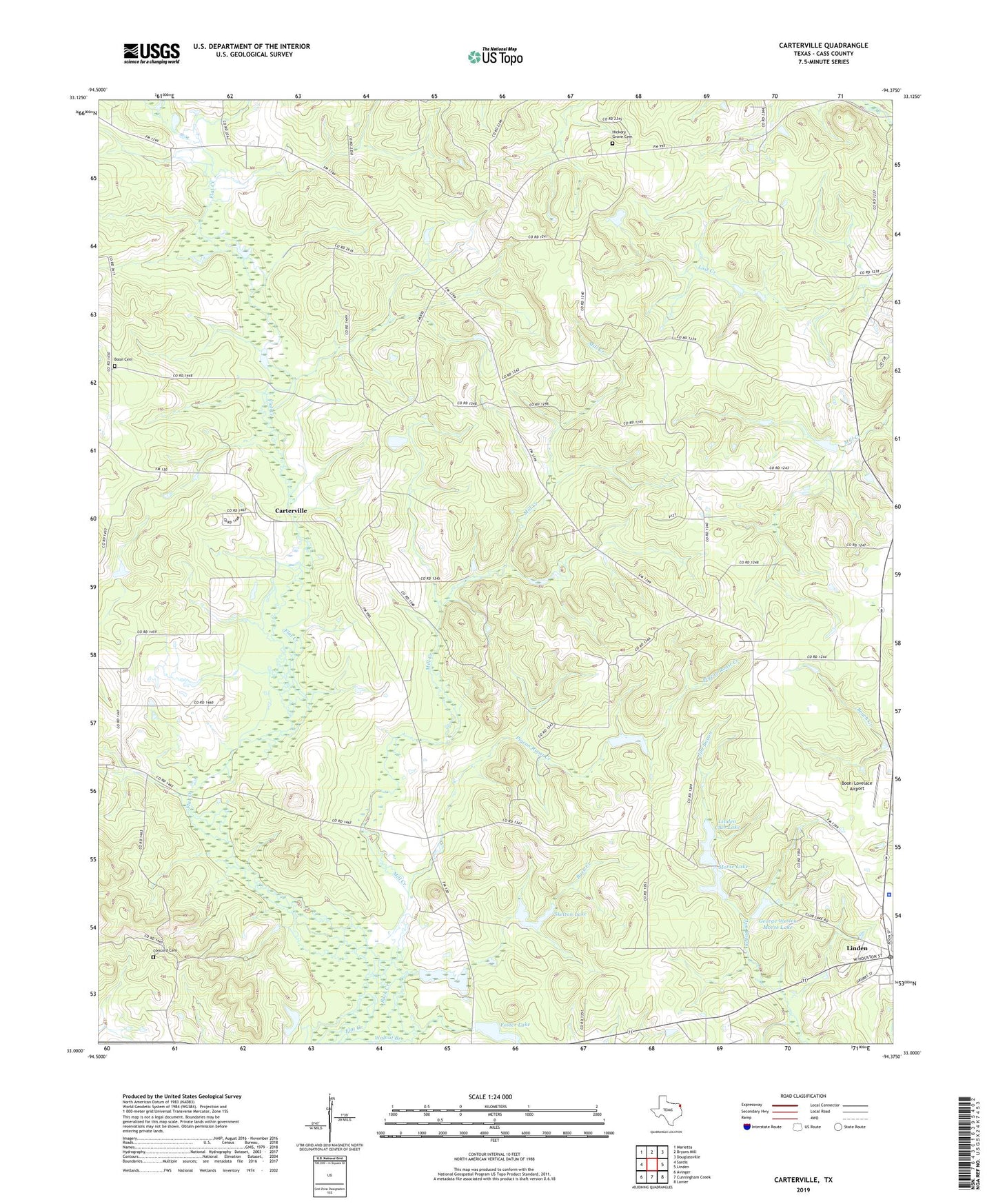
2019 topographic map quadrangle Carterville in the state of Texas. Scale: 1:24000. Based on the newly updated USGS 7.5' US Topo map series, this map is in the following counties: Cass. The map contains contour data, water features, and other items you are used to seeing on USGS maps, but also has updated roads and other features. This is the next generation of topographic maps. Printed on high-quality waterproof paper with UV fade-resistant inks.
Quads adjacent to this one:
West: Sardis
Northwest: Marietta
North: Bryans Mill
Northeast: Douglassville
East: Linden
Southeast: Lanier
South: Cunningham Creek
Southwest: Avinger
Contains the following named places: Almira, Antioch Church, Bethel-Cass Church, Boon Cemetery, Boon/Lovelace Airport, Buck Creek, Carterville, Cass County Constable's Office Precinct 1, Cass County Constable's Office Precinct 3, Cass County Jail, Cass County Sheriff's Office, Concord Cemetery, Corinth Church, Daniels Pond, Foster Lake, Foster Lake Dam, George Wesley Morse Lake, Hickory Grove Cemetery, Linden Club Dam, Linden Club Lake, Mill Creek, Mill Creek Church, Morse Dam, Morse Lake, Pigeon Roost Creek, Pleasant Hill, Skelton Lake, Skelton Lake Dam, Walnut Branch, Warren Springs, ZIP Code: 75563