MyTopo
Marietta Texas US Topo Map
Couldn't load pickup availability
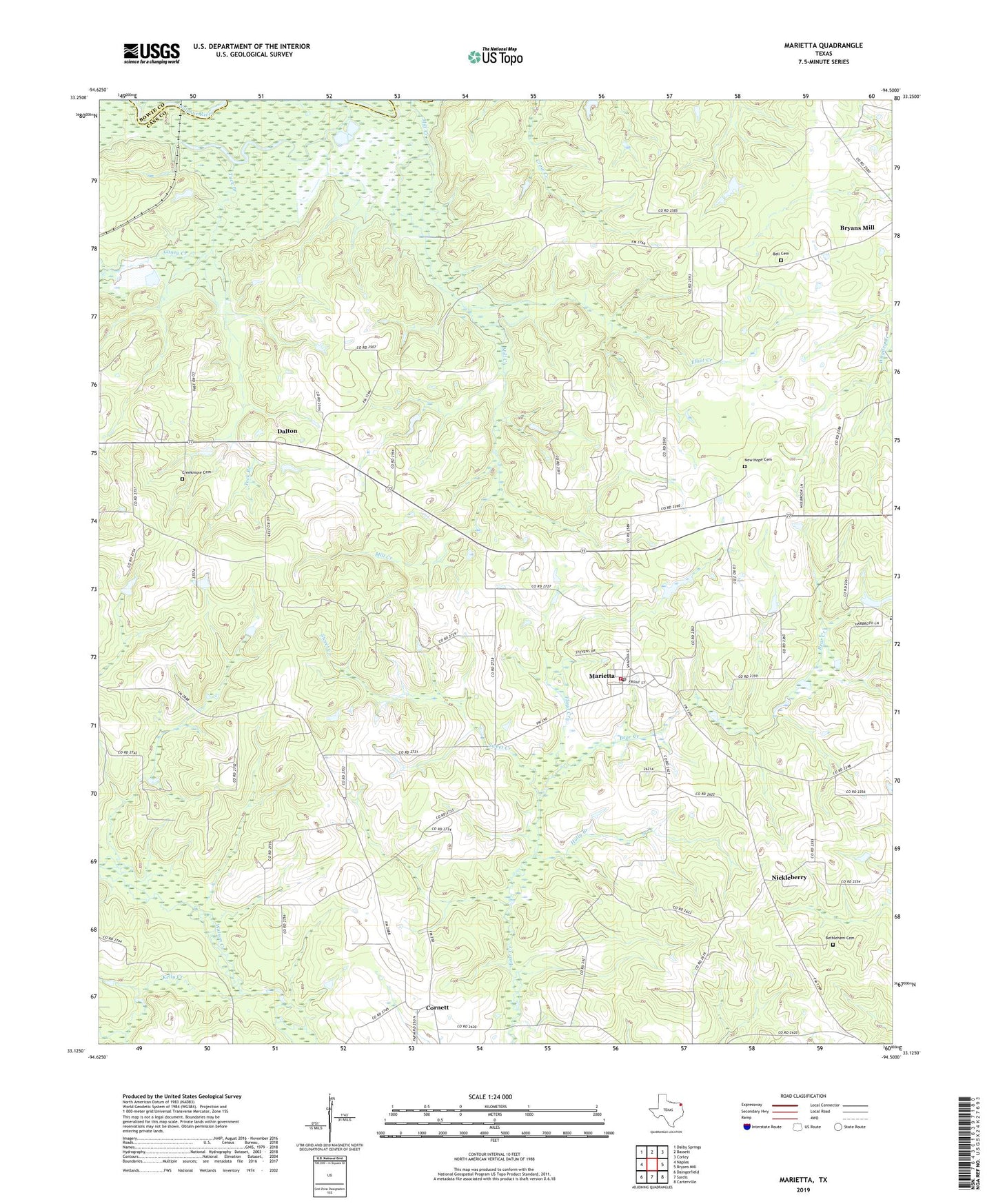
2022 topographic map quadrangle Marietta in the state of Texas. Scale: 1:24000. Based on the newly updated USGS 7.5' US Topo map series, this map is in the following counties: Cass, Bowie. The map contains contour data, water features, and other items you are used to seeing on USGS maps, but also has updated roads and other features. This is the next generation of topographic maps. Printed on high-quality waterproof paper with UV fade-resistant inks.
Quads adjacent to this one:
West: Naples
Northwest: Dalby Springs
North: Bassett
Northeast: Corley
East: Bryans Mill
Southeast: Carterville
South: Sardis
Southwest: Daingerfield
This map covers the same area as the classic USGS quad with code o33094b5.
Contains the following named places: Bell Cemetery, Bethlehem, Bethlehem Cemetery, Bethlehem Church, Caney Creek, Cornett, Creekmore Cemetery, Dalton, Elliot Creek, Floyd Creek, Gethsemane Church, Holly Branch, Jennings Lake, Marietta, Marietta Fire Department, Marietta Post Office, New Hope Cemetery, New Hope Church, Nickleberry, Sweet Creek, Town of Marietta, Tuck Branch, Watson Creek, ZIP Code: 75568