MyTopo
Douglassville Texas US Topo Map
Couldn't load pickup availability
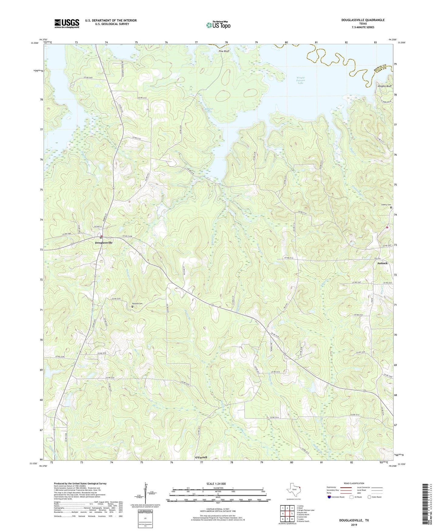
2022 topographic map quadrangle Douglassville in the state of Texas. Scale: 1:24000. Based on the newly updated USGS 7.5' US Topo map series, this map is in the following counties: Cass, Bowie. The map contains contour data, water features, and other items you are used to seeing on USGS maps, but also has updated roads and other features. This is the next generation of topographic maps. Printed on high-quality waterproof paper with UV fade-resistant inks.
Quads adjacent to this one:
West: Bryans Mill
Northwest: Corley
North: Maud
Northeast: Wright Patman Lake
East: Atlanta North
Southeast: Atlanta South
South: Linden
Southwest: Carterville
This map covers the same area as the classic USGS quad with code o33094b3.
Contains the following named places: Antioch, Armstrong Creek, Armstrong Landing, Atlanta State Park Trail, Ballard Creek, Carters Chapel, Cass County Constable's Office Precinct 2, Cass County Fire District 2 Antioch Station, Douglassville, Douglassville Post Office, Douglassville Volunteer Fire Department - First Responders, Douglasville Creek, Douglasville Lookout, Ellington Creek, Forest Hill Church, Gum Springs, Ham Creek, Jackson Creek, Jackson Park, Kickapoo Lodge, Knights Bluff, Knights Bluff Landing, Liberty Cemetery, Midway, Midway Branch, New Hope Church, New Liberty, O'Farrell Cemetery, Overcup Landing, Panhandle, Pine Bluff, Poorboy Landing, Prairie Branch, Rutland Cemetery, Saint James Church, Saint John Church, Shoal Creek, Town of Douglassville, Webster Creek, ZIP Code: 75560