MyTopo
Cunningham Creek Texas US Topo Map
Couldn't load pickup availability
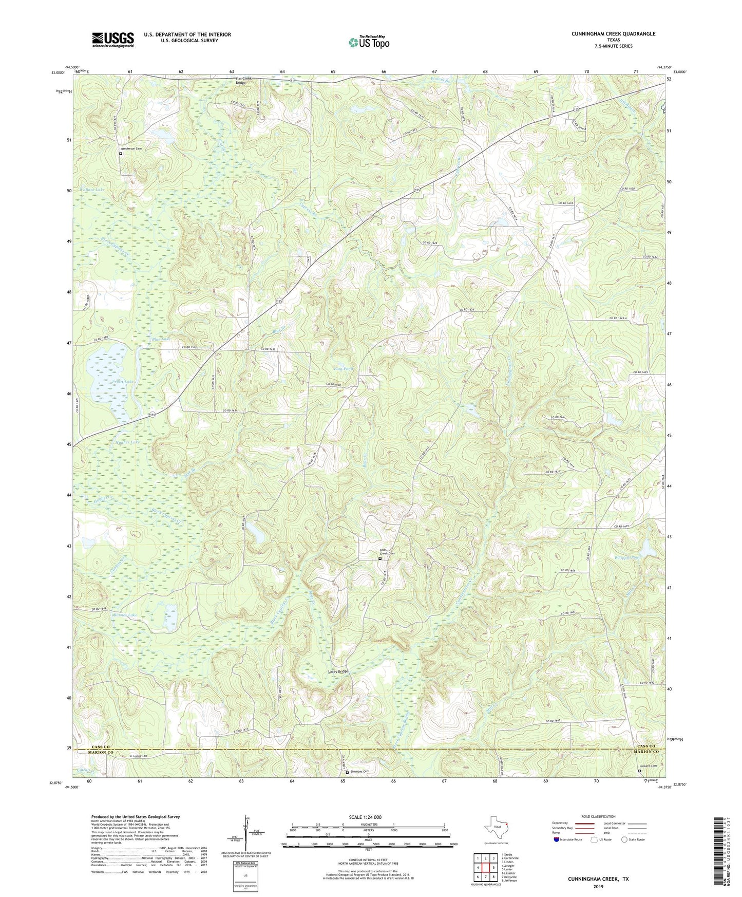
2022 topographic map quadrangle Cunningham Creek in the state of Texas. Scale: 1:24000. Based on the newly updated USGS 7.5' US Topo map series, this map is in the following counties: Cass, Marion. The map contains contour data, water features, and other items you are used to seeing on USGS maps, but also has updated roads and other features. This is the next generation of topographic maps. Printed on high-quality waterproof paper with UV fade-resistant inks.
Quads adjacent to this one:
West: Avinger
Northwest: Sardis
North: Carterville
Northeast: Linden
East: Lanier
Southeast: Jefferson
South: Kellyville
Southwest: Lassater
This map covers the same area as the classic USGS quad with code o32094h4.
Contains the following named places: Antioch Church, Barnes Lake, Bear Creek, Bear Creek Cemetery, Bethlehem Church, Black Cypress Creek, Blue Branch, Blue Lake, Cannon Creek, Caves Spring, Caves Spring Church, Cunningham Creek, Cypress Branch, Fairview, Flag Pond, Flat Creek, Flat Creek Bridge, Henderson Cemetery, Hughes Creek, Hughes Lake, Lacey Bridge, Liberty, Liberty Church, Lockett Cemetery, Pruitt Lake, Simmons Cemetery, Wallace Lake, Wells Church, Whipple Pond