
MyTopo
Cerro Alto Mountain Texas US Topo Map
Couldn't load pickup availability
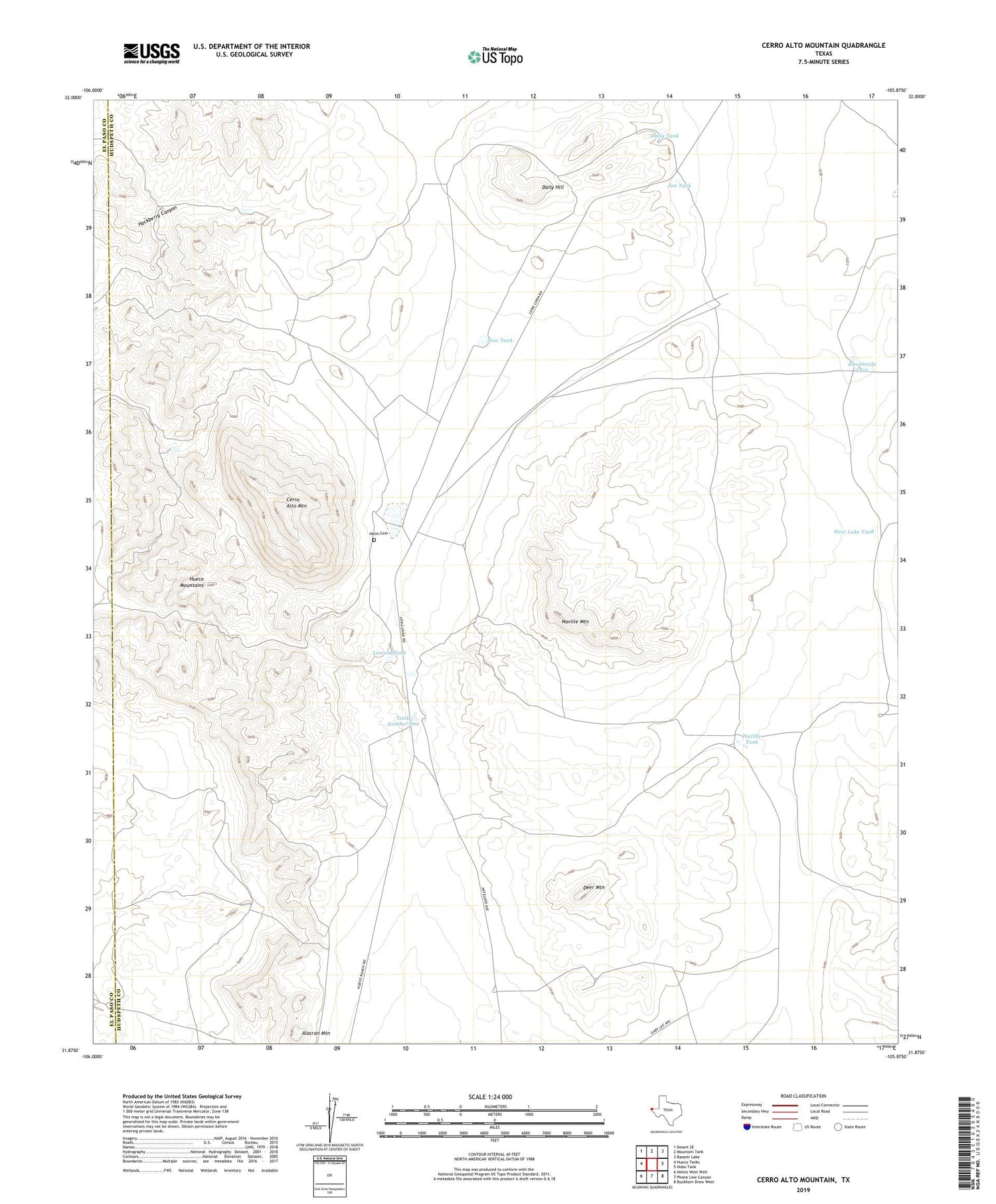
2019 topographic map quadrangle Cerro Alto Mountain in the state of Texas. Scale: 1:24000. Based on the newly updated USGS 7.5' US Topo map series, this map is in the following counties: Hudspeth, El Paso. The map contains contour data, water features, and other items you are used to seeing on USGS maps, but also has updated roads and other features. This is the next generation of topographic maps. Printed on high-quality waterproof paper with UV fade-resistant inks.
Quads adjacent to this one:
West: Hueco Tanks
Northwest: Desert SE
North: Mountain Tank
Northeast: Bassett Lake
East: Hobo Tank
Southeast: Buckhorn Draw West
South: Phone Line Canyon
Southwest: Helms West Well
Contains the following named places: Alacran Mountain, Burro Well, Cement Tank, Cerro Alto Mountain, Daily Hill, Daily Tank, Deer Mountain, Dugout Tank, Elevenmile Tank, Goat Tub Tank, Hackberry Tank, Helm Cemetery, Jim Tank, Lincoln Tank, Naville Mountain, Naville Tank, New Tank, North Well, Tank Number One, Well Number One, West Lake Tank


