MyTopo
Chillicothe Texas US Topo Map
Couldn't load pickup availability
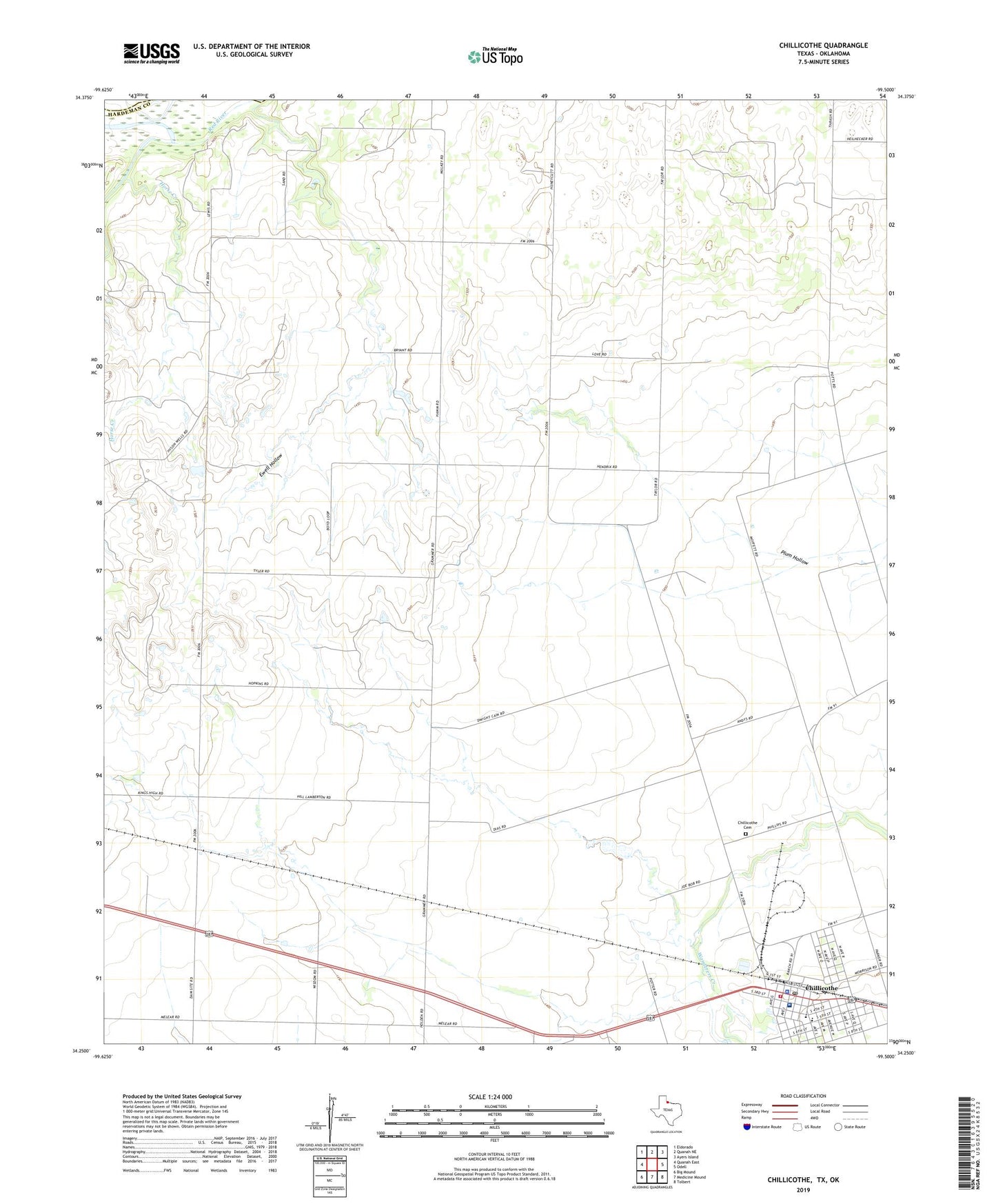
2019 topographic map quadrangle Chillicothe in the state of Texas. Scale: 1:24000. Based on the newly updated USGS 7.5' US Topo map series, this map is in the following counties: Hardeman, Jackson. The map contains contour data, water features, and other items you are used to seeing on USGS maps, but also has updated roads and other features. This is the next generation of topographic maps. Printed on high-quality waterproof paper with UV fade-resistant inks.
Quads adjacent to this one:
West: Quanah East
Northwest: Eldorado
North: Quanah NE
Northeast: Ayers Island
East: Odell
Southeast: Tolbert
South: Medicine Mound
Southwest: Big Mound
Contains the following named places: Barnett Airport, Chillicothe, Chillicothe Cemetery, Chillicothe City Hall, Chillicothe Elementary School, Chillicothe Hospital, Chillicothe Police Department, Chillicothe Post Office, Chillicothe Volunteer Fire Department, City of Chillicothe, Ewell Hollow, Groesbeck Creek, Hardeman County Emergency Medical Services Chillicothe, Horse Creek, King School, ZIP Code: 79225