MyTopo
Ayers Island Texas US Topo Map
Couldn't load pickup availability
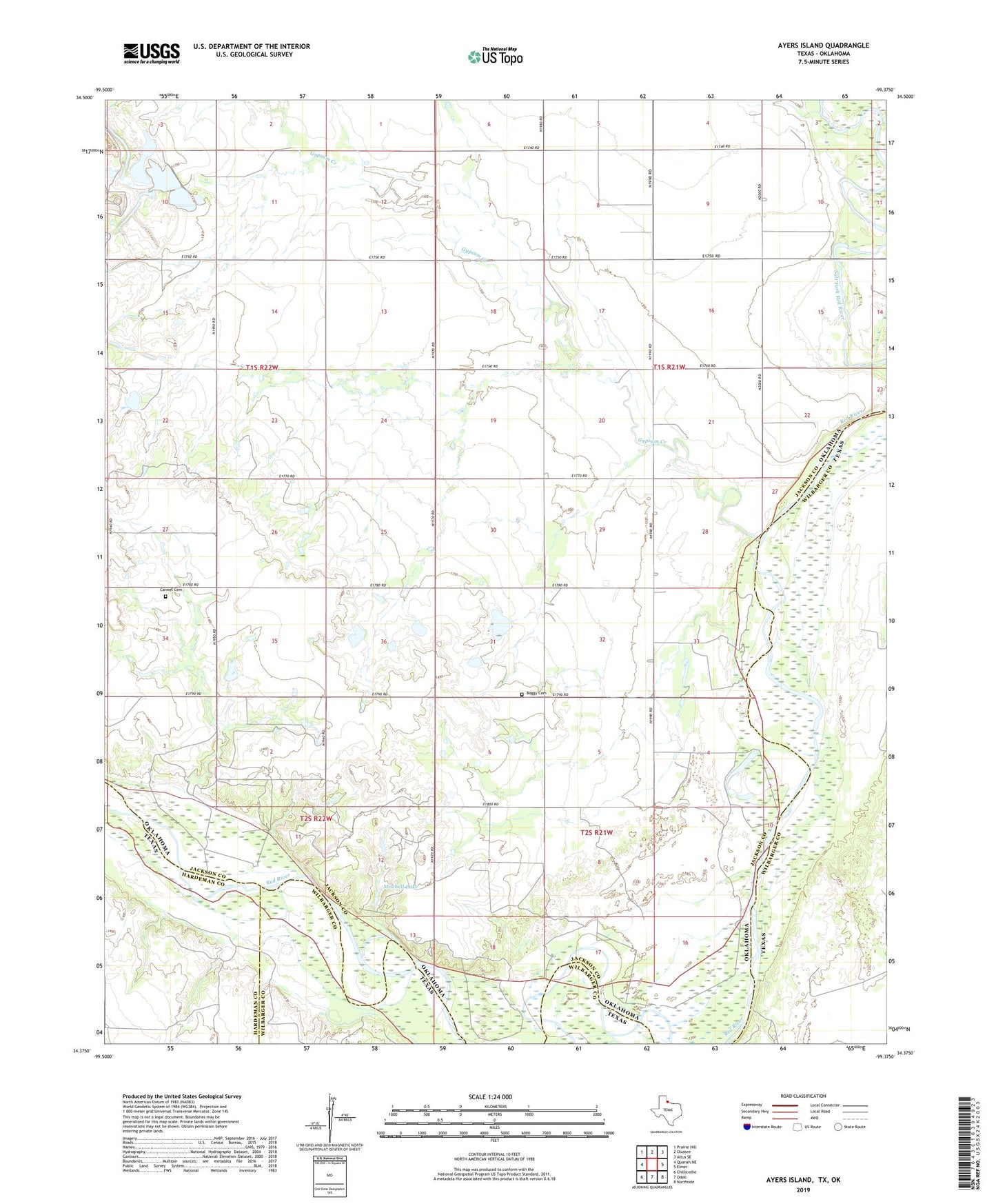
2022 topographic map quadrangle Ayers Island in the states of Oklahoma, Texas. Scale: 1:24000. Based on the newly updated USGS 7.5' US Topo map series, this map is in the following counties: Wilbarger, Jackson, Hardeman. The map contains contour data, water features, and other items you are used to seeing on USGS maps, but also has updated roads and other features. This is the next generation of topographic maps. Printed on high-quality waterproof paper with UV fade-resistant inks.
Quads adjacent to this one:
West: Quanah NE
Northwest: Prairie Hill
North: Olustee
Northeast: Altus SE
East: Elmer
Southeast: Northside
South: Odell
Southwest: Chillicothe
This map covers the same area as the classic USGS quad with code o34099d4.
Contains the following named places: Ayers Island, Boggy Cemetery, Carmel Cemetery, Crata Mine, Gypsum Creek, Mitchell Lake, Mitchell Lake Dam, Ranchland, Township of Carmel, Wanderers Creek