MyTopo
Church Peak Texas US Topo Map
Couldn't load pickup availability
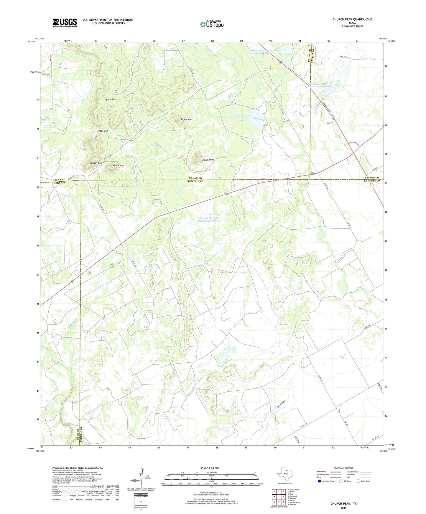
2019 topographic map quadrangle Church Peak in the state of Texas. Scale: 1:24000. Based on the newly updated USGS 7.5' US Topo map series, this map is in the following counties: Runnels, Nolan, Coke, Taylor. The map contains contour data, water features, and other items you are used to seeing on USGS maps, but also has updated roads and other features. This is the next generation of topographic maps. Printed on high-quality waterproof paper with UV fade-resistant inks.
Quads adjacent to this one:
West: Blackwell
Northwest: Blackwell NE
North: Hylton
Northeast: Shep
East: Wingate
Southeast: Wilmeth
South: Hog Mountain
Southwest: Bronte
Contains the following named places: Cedar Gap, Cedar Mountain, Church Peak, Fort Chadbourne, Fort Chadbourne Oil Field, Hylton Mountain, Jackson Mountain, Mathis Mountain, Odom Currie Wylie Estate Lake Number 1, Odom Currie Wylie Estate Lake Number 1 Dam, Odom Currie Wylie Estate Lake Number 2, Odom Currie Wylie Estate Lake Number 2 Dam, Soil Conservation Service Site 1 Dam, Soil Conservation Service Site 1 Reservoir, Soil Conservation Service Site 2a Dam, Soil Conservation Service Site 2a Reservoir, Soil Conservation Service Site 3 Dam, Soil Conservation Service Site 3 Reservoir, Williams Branch, ZIP Code: 79566