MyTopo
Wingate Texas US Topo Map
Couldn't load pickup availability
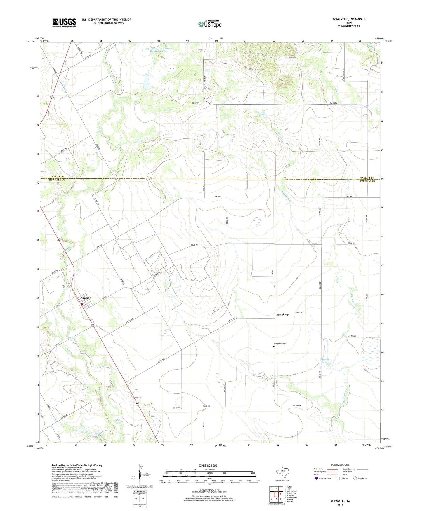
2022 topographic map quadrangle Wingate in the state of Texas. Scale: 1:24000. Based on the newly updated USGS 7.5' US Topo map series, this map is in the following counties: Runnels, Taylor. The map contains contour data, water features, and other items you are used to seeing on USGS maps, but also has updated roads and other features. This is the next generation of topographic maps. Printed on high-quality waterproof paper with UV fade-resistant inks.
Quads adjacent to this one:
West: Church Peak
Northwest: Hylton
North: Shep
Northeast: Lake Abilene
East: Bradshaw
Southeast: Winters
South: Wilmeth
Southwest: Hog Mountain
This map covers the same area as the classic USGS quad with code o32100a1.
Contains the following named places: Fish Creek, Mitchell Dam, Mitchell Lake, Pumphrey, Pumphrey Cemetery, Soil Conservation Service Site 16 Dam, Soil Conservation Service Site 16 Reservoir, Soil Conservation Service Site 17 Dam, Soil Conservation Service Site 17 Reservoir, Wingate, Wingate Cemetery, Wingate Census Designated Place, Wingate Post Office, Wingate Volunteer Fire Department