MyTopo
Hylton Texas US Topo Map
Couldn't load pickup availability
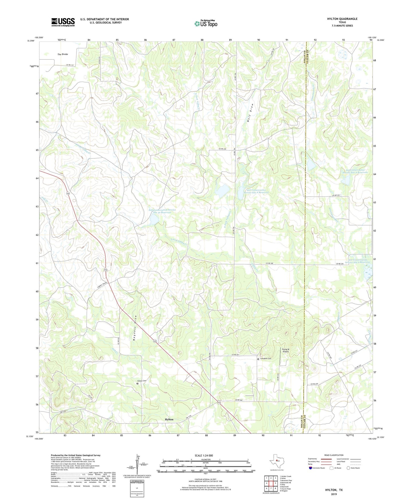
2022 topographic map quadrangle Hylton in the state of Texas. Scale: 1:24000. Based on the newly updated USGS 7.5' US Topo map series, this map is in the following counties: Nolan, Taylor. The map contains contour data, water features, and other items you are used to seeing on USGS maps, but also has updated roads and other features. This is the next generation of topographic maps. Printed on high-quality waterproof paper with UV fade-resistant inks.
Quads adjacent to this one:
West: Blackwell NE
Northwest: Holder Creek
North: Nolan
Northeast: Mountain Pass
East: Shep
Southeast: Wingate
South: Church Peak
Southwest: Blackwell
This map covers the same area as the classic USGS quad with code o32100b2.
Contains the following named places: Campbell Cemetery, Flying W Airport, High Lonesome Windmill, Hylton, Hylton Cemetery, Magness Draw, North Fork Valley Creek, Soil Conservation Service Site 4a Dam, Soil Conservation Service Site 4a Reservoir, Soil Conservation Service Site 5 Dam, Soil Conservation Service Site 5 Reservoir, Soil Conservation Service Site 6 Dam, Soil Conservation Service Site 6 Reservoir, Soil Conservation Service Site 7 Dam, Soil Conservation Service Site 7 Reservoir, Soil Conservation Service Site 8 Dam, Soil Conservation Service Site 8 Reservoir, Soil Conservation Service Site 9 Dam, Soil Conservation Service Site 9 Reservoir, South Fork Valley Creek, Wolf Draw