MyTopo
Wilmeth Texas US Topo Map
Couldn't load pickup availability
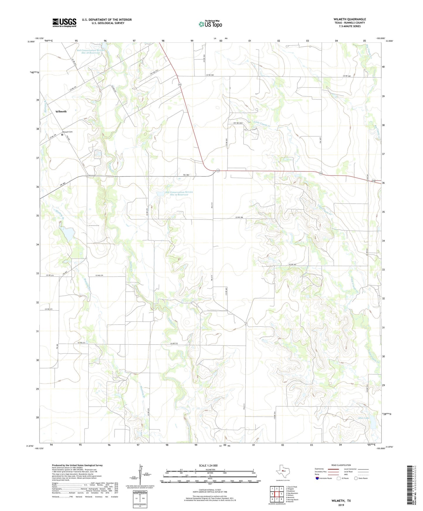
2022 topographic map quadrangle Wilmeth in the state of Texas. Scale: 1:24000. Based on the newly updated USGS 7.5' US Topo map series, this map is in the following counties: Runnels. The map contains contour data, water features, and other items you are used to seeing on USGS maps, but also has updated roads and other features. This is the next generation of topographic maps. Printed on high-quality waterproof paper with UV fade-resistant inks.
Quads adjacent to this one:
West: Hog Mountain
Northwest: Church Peak
North: Wingate
Northeast: Bradshaw
East: Winters
Southeast: Hatchel
South: Herring Ranch
Southwest: Maverick
This map covers the same area as the classic USGS quad with code o31100h1.
Contains the following named places: Allen Lake, Allen Lake Dam, Lutheran Cemetery, Old Norton Church, Soil Conservation Service Site 18 Dam, Soil Conservation Service Site 18 Reservoir, Soil Conservation Service Site 19 Dam, Soil Conservation Service Site 19 Reservoir, Soil Conservation Service Site 20 Dam, Soil Conservation Service Site 20 Reservoir, Wilmeth, Wilmeth Cemetery