
MyTopo
Clarendon SE Texas US Topo Map
Couldn't load pickup availability
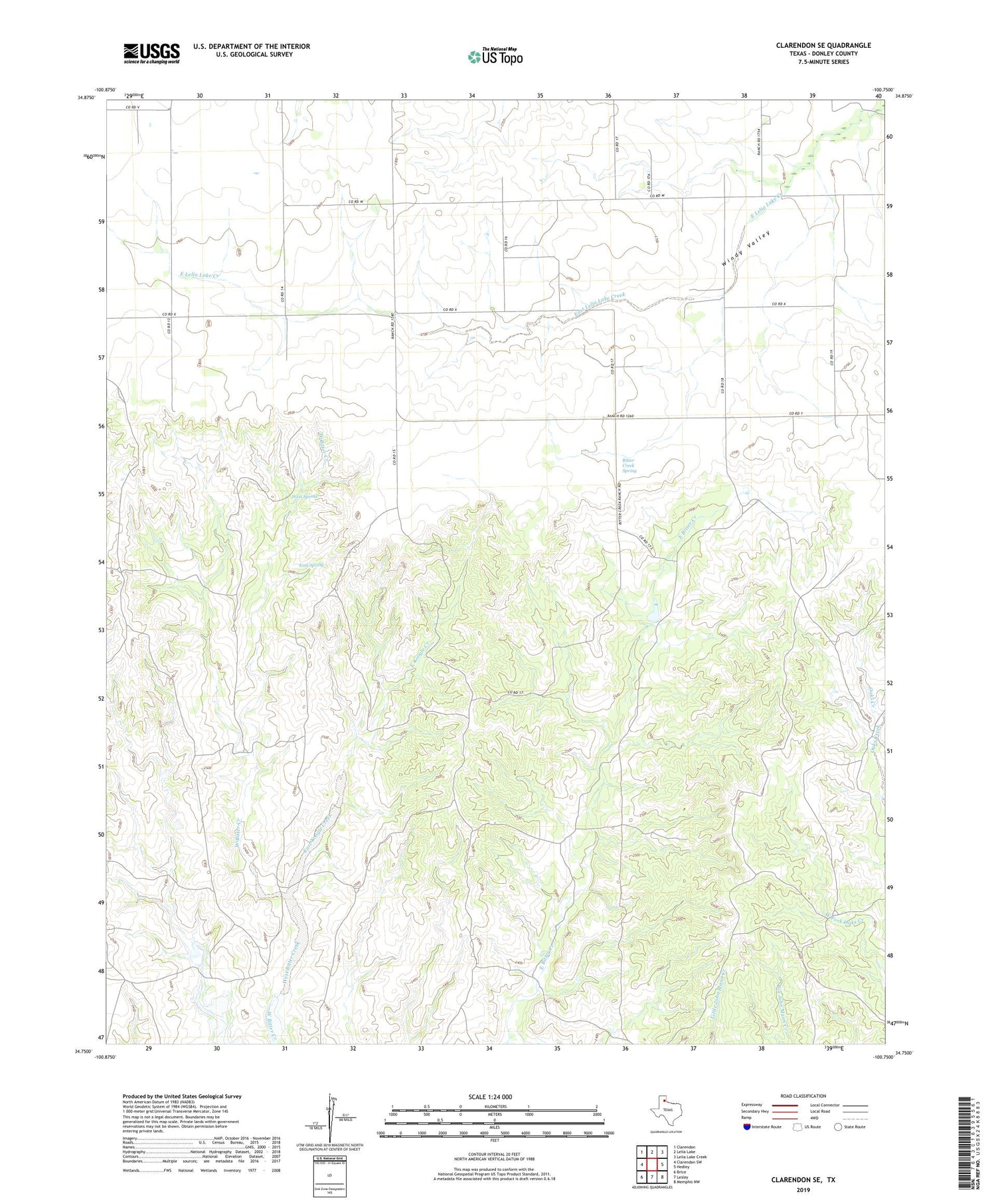
2019 topographic map quadrangle Clarendon SE in the state of Texas. Scale: 1:24000. Based on the newly updated USGS 7.5' US Topo map series, this map is in the following counties: Donley. The map contains contour data, water features, and other items you are used to seeing on USGS maps, but also has updated roads and other features. This is the next generation of topographic maps. Printed on high-quality waterproof paper with UV fade-resistant inks.
Quads adjacent to this one:
West: Clarendon SW
Northwest: Clarendon
North: Lelia Lake
Northeast: Lelia Lake Creek
East: Hedley
Southeast: Memphis NW
South: Lesley
Southwest: Brice
Contains the following named places: Bitter Creek Ranch, Bitter Creek Ranch Lake, Bitter Creek Ranch Lake Dam, Bitter Creek Spring, Chamberlain Community Center, East Koogle Creek, East Spring, West Spring, Windy Valley


