MyTopo
Lesley Texas US Topo Map
Couldn't load pickup availability
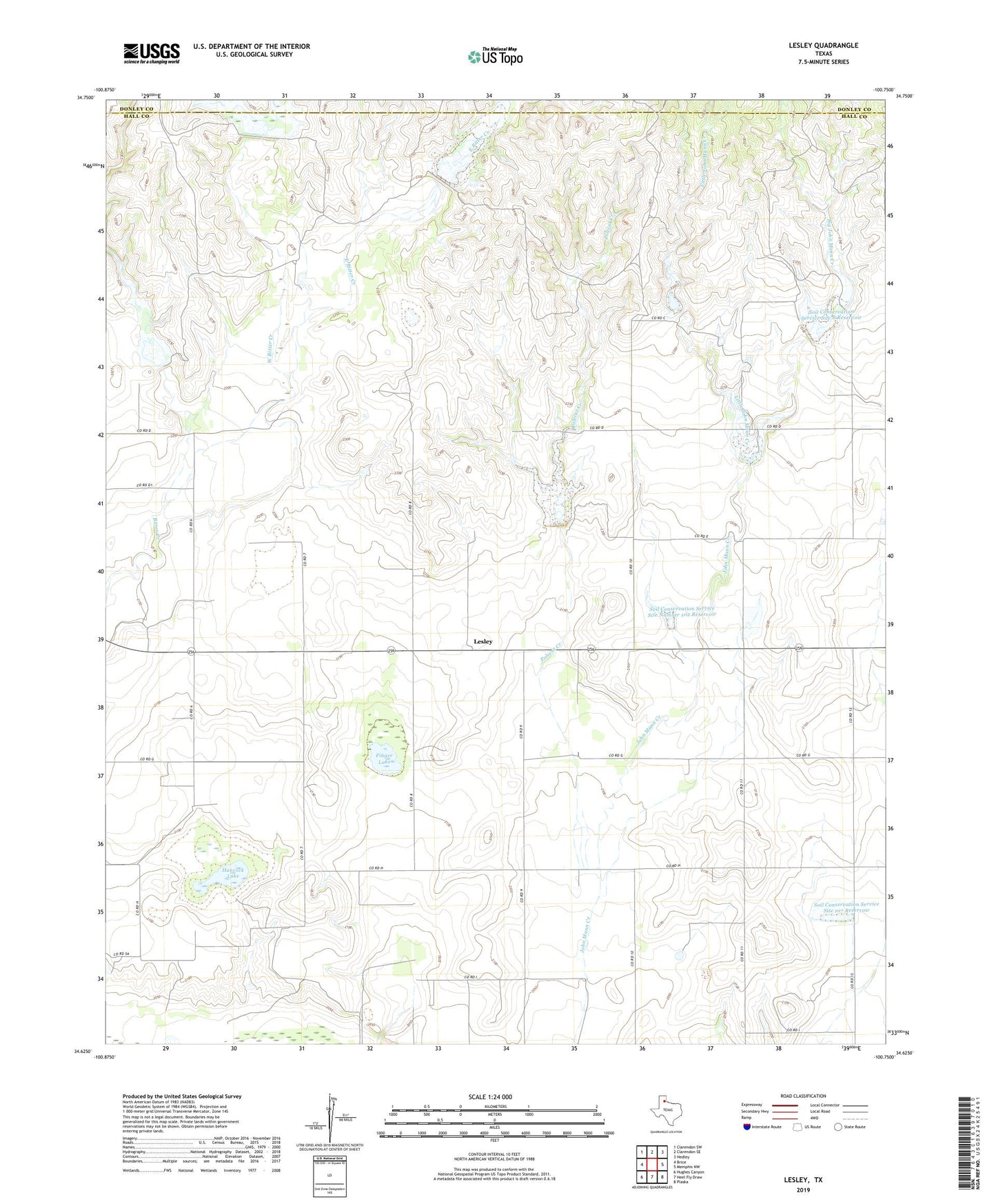
2022 topographic map quadrangle Lesley in the state of Texas. Scale: 1:24000. Based on the newly updated USGS 7.5' US Topo map series, this map is in the following counties: Hall, Donley. The map contains contour data, water features, and other items you are used to seeing on USGS maps, but also has updated roads and other features. This is the next generation of topographic maps. Printed on high-quality waterproof paper with UV fade-resistant inks.
Quads adjacent to this one:
West: Brice
Northwest: Clarendon SW
North: Clarendon SE
Northeast: Hedley
East: Memphis NW
Southeast: Plaska
South: Heel Fly Draw
Southwest: Hughes Canyon
This map covers the same area as the classic USGS quad with code o34100f7.
Contains the following named places: Big John Mann Creek, East Bitter Creek, Finger Lake, Hancock Lake, Lakeview Division, Lesley, Little John Mann Creek, Soil Conservation Service Site 101 Reservoir, Soil Conservation Service Site 107 Dam, Soil Conservation Service Site 107 Reservoir, Soil Conservation Service Site 3 Dam, Soil Conservation Service Site 3 Reservoir, Soil Conservation Service Site 4 Dam, Soil Conservation Service Site 4 Reservoir, Soil Conservation Service Site 5 Dam, Soil Conservation Service Site 5 Reservoir, Soil Conservation Service Site 6 Dam, Soil Conservation Service Site 6 Reservoir, Soil Conservation Service Site 7 Dam, Soil Conservation Service Site 7 Reservoir, Soil Conservation Service Site 8 Dam, Soil Conservation Service Site 8 Reservoir, Soil Conservation Service Site Number 101 Dam, Soil Conservation Service Site Number 102 Dam, Soil Conservation Service Site Number 102 Reservoir, Soil Conservation Service Site Number 103 Dam, Soil Conservation Service Site Number 103 Reservoir, West Bitter Creek, ZIP Code: 79239