MyTopo
Clarendon Texas US Topo Map
Couldn't load pickup availability
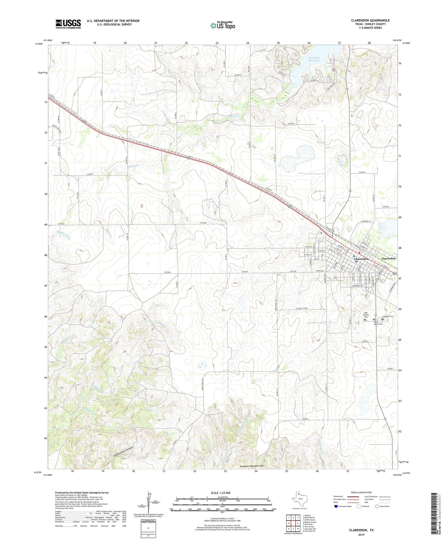
2022 topographic map quadrangle Clarendon in the state of Texas. Scale: 1:24000. Based on the newly updated USGS 7.5' US Topo map series, this map is in the following counties: Donley. The map contains contour data, water features, and other items you are used to seeing on USGS maps, but also has updated roads and other features. This is the next generation of topographic maps. Printed on high-quality waterproof paper with UV fade-resistant inks.
Quads adjacent to this one:
West: Buffalo Arroyo
Northwest: Ashtola
North: Roach Ranch
Northeast: Griffin Ranch
East: Lelia Lake
Southeast: Clarendon SE
South: Clarendon SW
Southwest: Tate Arroyo
This map covers the same area as the classic USGS quad with code o34100h8.
Contains the following named places: Associated Ambulance Authority, Citizens Cemetery, City of Clarendon, Clarendon, Clarendon City Hall, Clarendon Elementary School, Clarendon High School, Clarendon Junior High School, Clarendon Lake, Clarendon Motor Company Building, Clarendon Post Office, Clarendon Volunteer Fire Department, Donley County Constable's Office, Donley County Sheriff's Office, East Halls Creek, Gunboat Mountain, Martin Church, Martin-Lowe House, Odd Fellows Cemetery, Prospect Park, Saint Marys Cemetery, ZIP Code: 79226