MyTopo
Clear Lake Texas US Topo Map
Couldn't load pickup availability
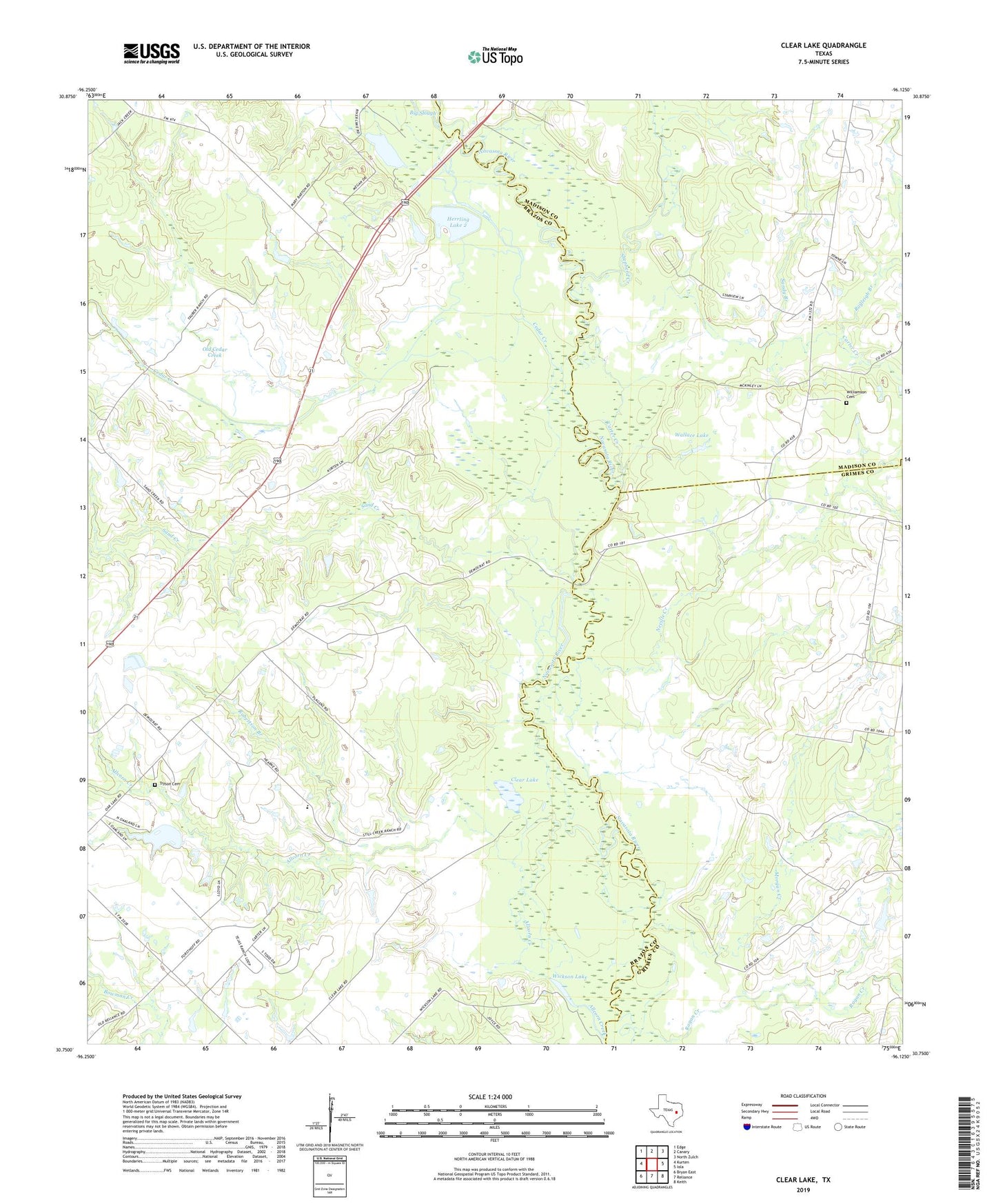
2019 topographic map quadrangle Clear Lake in the state of Texas. Scale: 1:24000. Based on the newly updated USGS 7.5' US Topo map series, this map is in the following counties: Brazos, Grimes, Madison. The map contains contour data, water features, and other items you are used to seeing on USGS maps, but also has updated roads and other features. This is the next generation of topographic maps. Printed on high-quality waterproof paper with UV fade-resistant inks.
Quads adjacent to this one:
West: Kurten
Northwest: Edge
North: Canary
Northeast: North Zulch
East: Iola
Southeast: Keith
South: Reliance
Southwest: Bryan East
Contains the following named places: Allcorn Creek, Bonham Public Library, Brushy Lake, Carter Creek, Cedar Creek, Clear Lake, Democrat Crossing, Hall Lake, Herrling Lake 2, Herrling Lake 2 Dam, Hunter Lake, Hunter Lake Dam, Morgan Creek, Neville Creek, Oakland Lake, Oakland Lake Dam, Old Cedar Creek, Ragan Creek, Rayleigh Branch, Robertson Branch, Sand Creek, Sandy Branch, Shepherd Creek, Three Bridges, Tryson Cemetery, Wallace Lake, Wallace Lake Dam, Wickson Lake, Williamson Cemetery