MyTopo
Kurten Texas US Topo Map
Couldn't load pickup availability
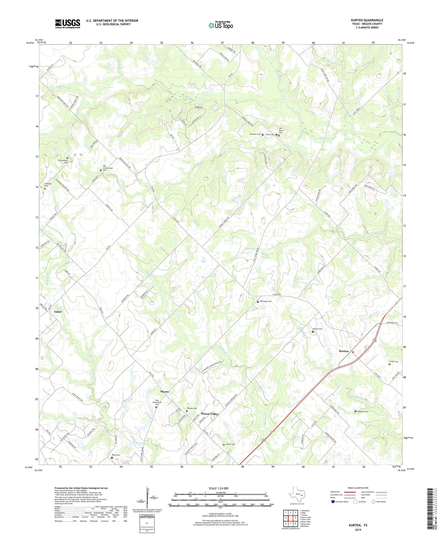
2022 topographic map quadrangle Kurten in the state of Texas. Scale: 1:24000. Based on the newly updated USGS 7.5' US Topo map series, this map is in the following counties: Brazos. The map contains contour data, water features, and other items you are used to seeing on USGS maps, but also has updated roads and other features. This is the next generation of topographic maps. Printed on high-quality waterproof paper with UV fade-resistant inks.
Quads adjacent to this one:
West: Dunn Creek
Northwest: Wheelock
North: Edge
Northeast: Canary
East: Clear Lake
Southeast: Reliance
South: Bryan East
Southwest: Bryan West
This map covers the same area as the classic USGS quad with code o30096g3.
Contains the following named places: Bee Creek, Bickham Cemetery, Brazos County Precinct 2 Volunteer Fire Department, City of Wixon Valley, Cottonwood, Cottonwood Church, Ebenezer Cemetery, Evans Cemetery, Ferrill Branch, Fridel Cemetery, Hog Creek, Holuber Cemetery, Iron Creek, Jack Creek, Jim Harris Cemetery, Kurten, Kurten Cemetery, Kurten Post Office, Kurten School, Moore, Moore School, New Bethlehem Cemetery, New Bethlehem Church, Northeast Brazos Division, Old Cottonwood Cemetery, Reed Cemetery, Rocky Creek, Schultze Cemetery, Sparks Branch, String Prairie, Tabor, Tabor Community Center, Tiger Branch, Town Branch, Town of Kurten, Union, Wesson Cemetery, Wixon Cemetery, Wixon Valley, Zion Church, ZIP Code: 77808