MyTopo
Clegg Texas US Topo Map
Couldn't load pickup availability
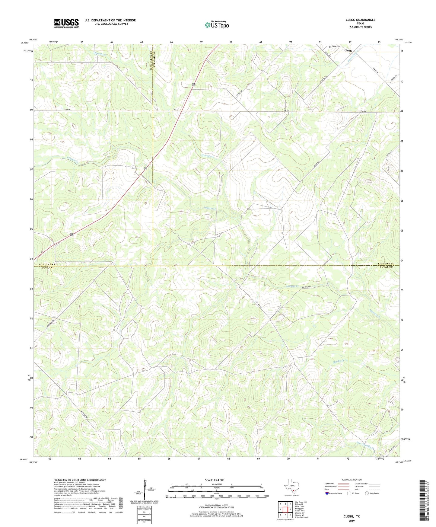
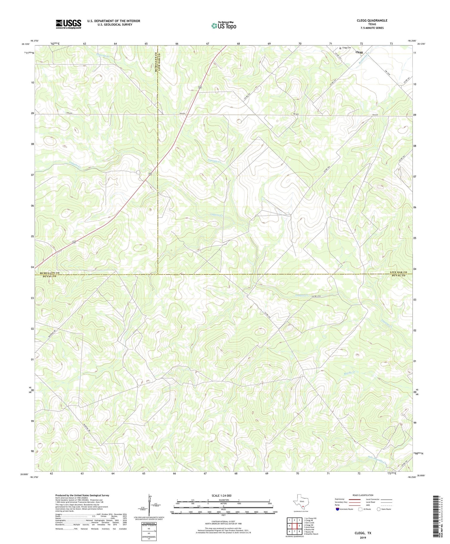
2019 topographic map quadrangle Clegg in the state of Texas. Scale: 1:24000. Based on the newly updated USGS 7.5' US Topo map series, this map is in the following counties: Duval, Live Oak, McMullen. The map contains contour data, water features, and other items you are used to seeing on USGS maps, but also has updated roads and other features. This is the next generation of topographic maps. Printed on high-quality waterproof paper with UV fade-resistant inks.
Quads adjacent to this one:
West: Clegg SW
Northwest: La Chusa Hill
North: Clegg NE
Northeast: Elm Creek
East: Anna Rose
Southeast: Shaeffer Ranch
South: Rosita NE
Southwest: Rosita NW
Contains the following named places: Benada Windmill, Cara Windmill, Clegg, Clegg Cemetery, Clegg Ranch, Clegg Windmill, Coyote Windmill, Delamar Windmill, Fuste Windmill, Garza Ranch, Goose Egg Windmill, Guajolote Windmill, Jack Windmill, Mala Suerte Windmill, Martin Ranch, New Well, New Windmill, Oil Well Windmill, Palacer Windmill, Panorama Windmill, Presa Windmill, Rancho Viejo Windmill, Rincon Windmill, Salt Well Windmill, Steel Windmill, Tepecate Creek