MyTopo
Rosita NW Texas US Topo Map
Couldn't load pickup availability
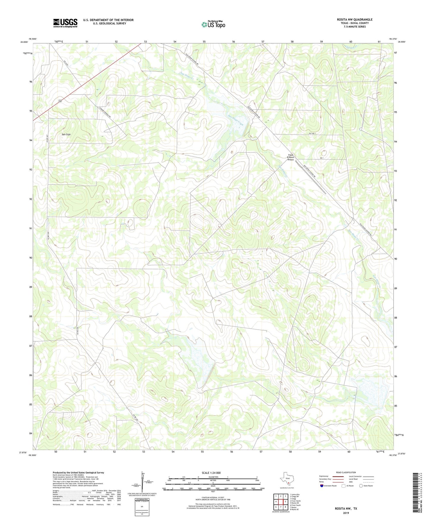
2022 topographic map quadrangle Rosita NW in the state of Texas. Scale: 1:24000. Based on the newly updated USGS 7.5' US Topo map series, this map is in the following counties: Duval. The map contains contour data, water features, and other items you are used to seeing on USGS maps, but also has updated roads and other features. This is the next generation of topographic maps. Printed on high-quality waterproof paper with UV fade-resistant inks.
Quads adjacent to this one:
West: Freer North
Northwest: Loma Alta
North: Clegg SW
Northeast: Clegg
East: Rosita NE
Southeast: Rosita SE
South: Rosita
Southwest: Freer South
This map covers the same area as the classic USGS quad with code o27098h4.
Contains the following named places: Blanca Windmill, Camp Windmill, Canogas Windmill, Cavazos Windmill, Cook Ranch, La Mota Windmill, North Windmill, Red Windmill, San Cajo, Soil Conservation Service Site 1 Dam, Soil Conservation Service Site 1 Reservoir, Soil Conservation Service Site 3 Dam, Soil Conservation Service Site 3 Reservoir, Soil Conservation Service Site 4 Dam, Soil Conservation Service Site 4 Reservoir, Triple B Ranch Airport, Venado Windmill, Walker Windmill