MyTopo
La Chusa Hill Texas US Topo Map
Couldn't load pickup availability
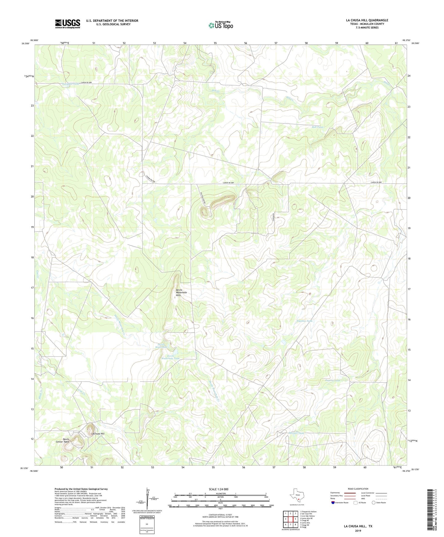
2022 topographic map quadrangle La Chusa Hill in the state of Texas. Scale: 1:24000. Based on the newly updated USGS 7.5' US Topo map series, this map is in the following counties: McMullen. The map contains contour data, water features, and other items you are used to seeing on USGS maps, but also has updated roads and other features. This is the next generation of topographic maps. Printed on high-quality waterproof paper with UV fade-resistant inks.
Quads adjacent to this one:
West: Loma Alta NE
Northwest: Fitzpatrick Hollow
North: San Caja Hill
Northeast: Live Oak Hollow
East: Clegg NE
Southeast: Clegg
South: Clegg SW
Southwest: Loma Alta
This map covers the same area as the classic USGS quad with code o28098b4.
Contains the following named places: Bartlett Windmills, Big Well Windmill, Buckhorn Windmill, Bull Tank, Chusa Windmill, Devils Center Table, Devils Waterhole, Devils Waterhole Hills, Devils Waterhole Tank, Dugout Tank, Encino Ranch, Gueydan House Windmill, Gueydan Tank, LaChusa Hill, LaChusa Ranch, Little Windmill, Magnolia Windmill, Manuel Tank, New Well Windmill, Novia Windmill, Pipeline Tank, Racon Windmill, Rhode Ranch, Three Corners Windmill, White Windmill