
MyTopo
Cliffside Texas US Topo Map
Couldn't load pickup availability
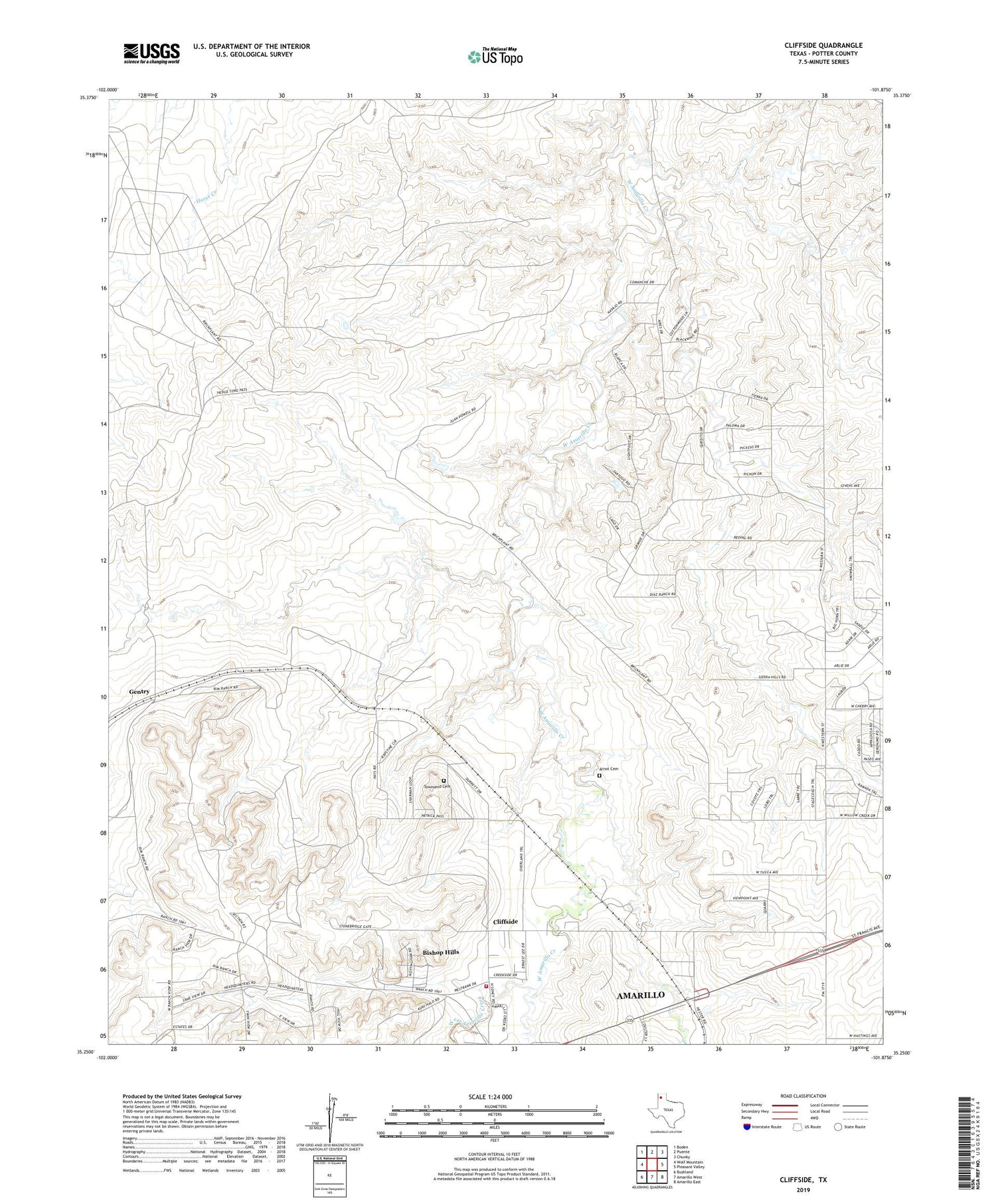
2019 topographic map quadrangle Cliffside in the state of Texas. Scale: 1:24000. Based on the newly updated USGS 7.5' US Topo map series, this map is in the following counties: Potter. The map contains contour data, water features, and other items you are used to seeing on USGS maps, but also has updated roads and other features. This is the next generation of topographic maps. Printed on high-quality waterproof paper with UV fade-resistant inks.
Quads adjacent to this one:
West: Wolf Mountain
Northwest: Boden
North: Puente
Northeast: Chunky
East: Pleasant Valley
Southeast: Amarillo East
South: Amarillo West
Southwest: Bushland
Contains the following named places: Amarillo Rifle and Pistol Club Firing Range, Arnot Cemetery, Bishop Hills, Bishop Ranch, Cliffside, Cliffside Baptist Church, Cliffside Gas Field Camp, Gentry, KLMN-FM (Amarillo), KLSF-FM (Amarillo), KRGN-FM (Amarillo), KVII-TV (Amarillo), McCollum Dairy, Potter County Fire Rescue Station 3, Town of Bishop Hills, Townsend Cemetery, Wesley Dairy, Wilkins Ranch, ZIP Code: 79124


