MyTopo
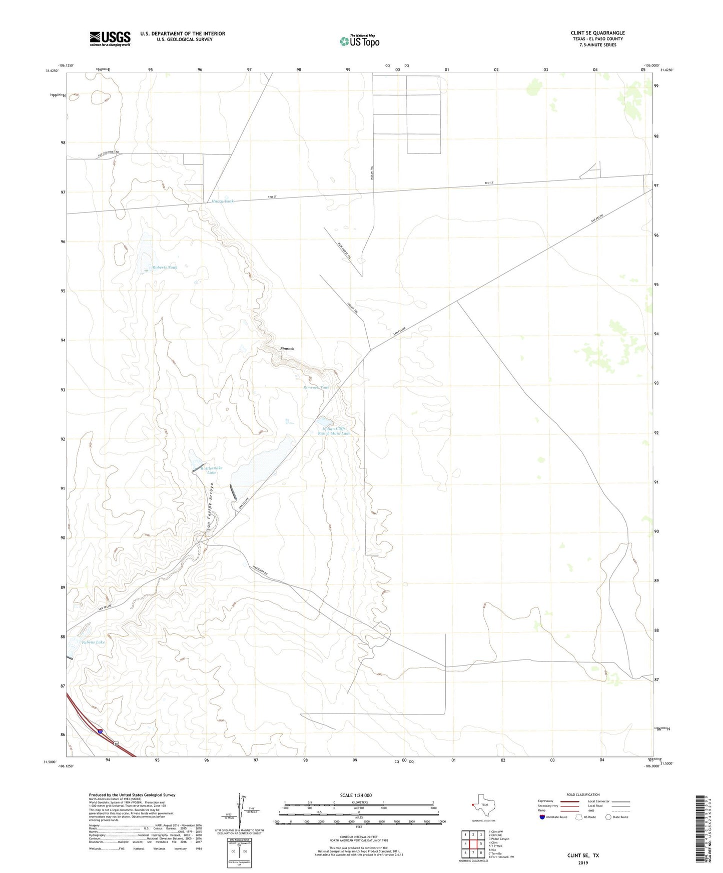
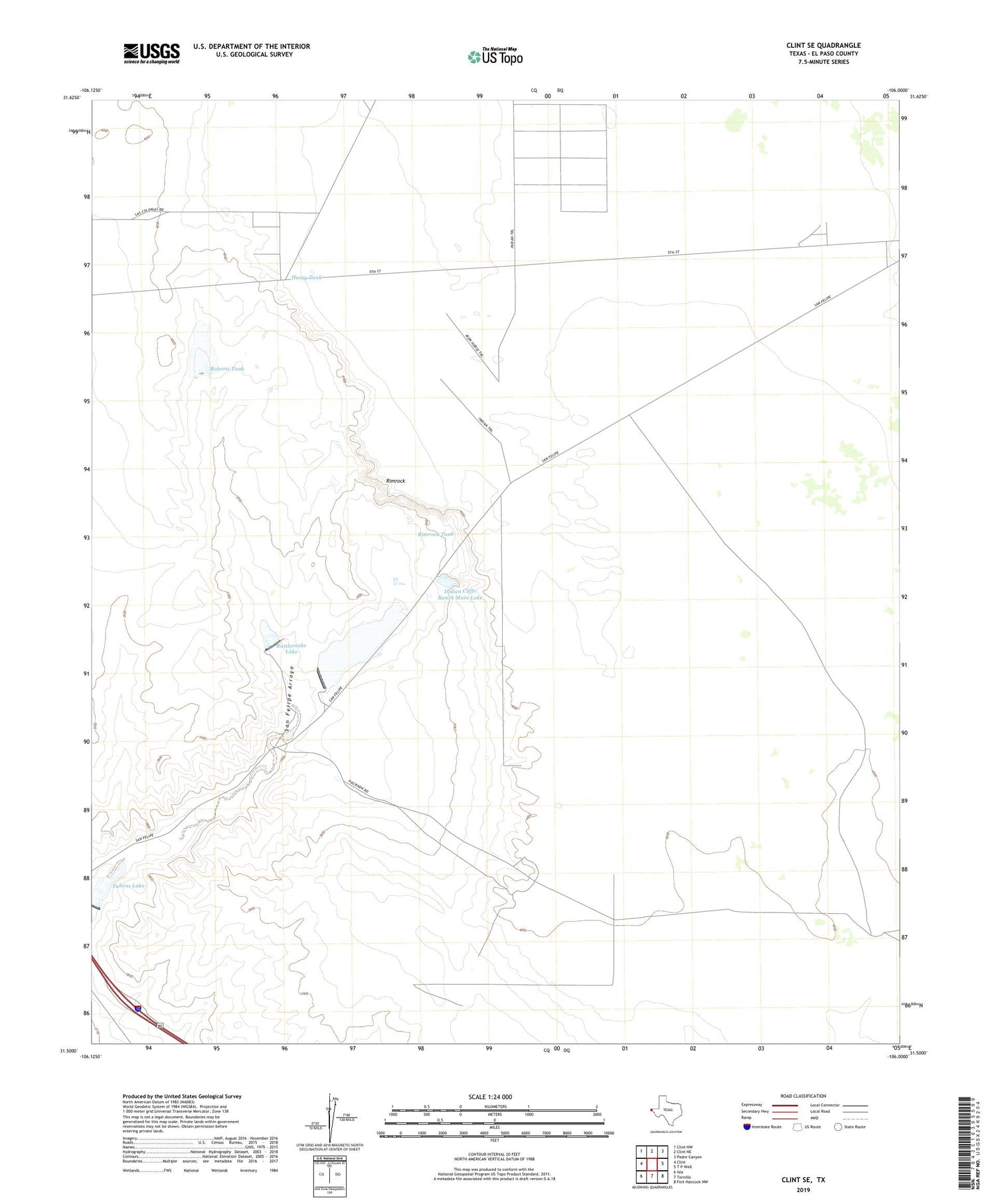
Clint SE Texas US Topo Map
Couldn't load pickup availability
2019 topographic map quadrangle Clint SE in the state of Texas. Scale: 1:24000. Based on the newly updated USGS 7.5' US Topo map series, this map is in the following counties: El Paso. The map contains contour data, water features, and other items you are used to seeing on USGS maps, but also has updated roads and other features. This is the next generation of topographic maps. Printed on high-quality waterproof paper with UV fade-resistant inks.
Quads adjacent to this one:
West: Clint
Northwest: Clint NW
North: Clint NE
Northeast: Padre Canyon
East: T P Well
Southeast: Fort Hancock NW
South: Tornillo
Southwest: Isla
Contains the following named places: Cattleman's North Ranchos Colonia, Cattleman's North Ranchos Number 2 Colonia, Cottonwood Dam, Cottonwood Lake, East Clint Estates Colonia, Fabens Desert Chapel, Fabens Lake, Harry Tank, Indian Cliff Ranch Main Lake Dam, Indian Cliffs Ranch Main Lake, New Well, Rattlesnake Dam, Rattlesnake Lake, Rimrock, Rimrock Tank, Roberts Dam, Roberts Tank, Roberts Tank Dam, T and P Well