MyTopo
Clint NW Texas US Topo Map
Couldn't load pickup availability
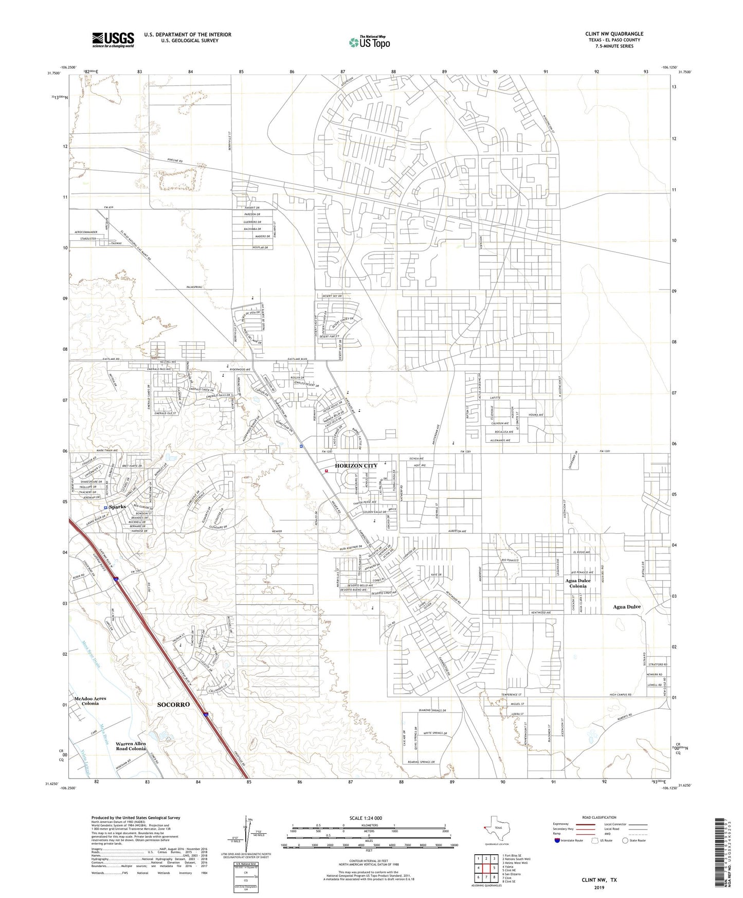
2022 topographic map quadrangle Clint NW in the state of Texas. Scale: 1:24000. Based on the newly updated USGS 7.5' US Topo map series, this map is in the following counties: El Paso. The map contains contour data, water features, and other items you are used to seeing on USGS maps, but also has updated roads and other features. This is the next generation of topographic maps. Printed on high-quality waterproof paper with UV fade-resistant inks.
Quads adjacent to this one:
West: Ysleta
Northwest: Fort Bliss SE
North: Nations South Well
Northeast: Helms West Well
East: Clint NE
Southeast: Clint SE
South: Clint
Southwest: San Elizario
This map covers the same area as the classic USGS quad with code o31106f2.
Contains the following named places: Agua Dulce, Agua Dulce Census Designated Place, Agua Dulce Colonia, Agua Dulce Number 2 Colonia, Agua Dulce Number 3 Colonia, Agua Dulce Number 4 Colonia, Agua Dulce Number 5 Colonia, City of Horizon City, Cochran Mobile Park Colonia, College Park Addition Colonia, Dairyland Colonia, El Paso County Sheriff's Office - Community Service Section, El Paso Transitional Center Multiuse Building, Horizon Airport, Horizon City, Horizon City Baptist Church, Horizon City City Hall, Horizon City Fire Department, Horizon City Park, Horizon City Police Department, Horizon Heights Elementary School, Joint Well, Life Ambulance Service Station 5, Mesa Drain, Mesa Spur Drain, Robert Rojas Elementary School, South Well, Sparks, Spark's Addition Colonia, Spark's Addition Number 2 Colonia, Spark's Addition Number 3 Colonia, Spark's Addition Number 4 Colonia, Sparks Census Designated Place, Warren Allen Road Colonia, Ysleta Lateral, ZIP Code: 79928