
MyTopo
Collins Creek Texas US Topo Map
Couldn't load pickup availability
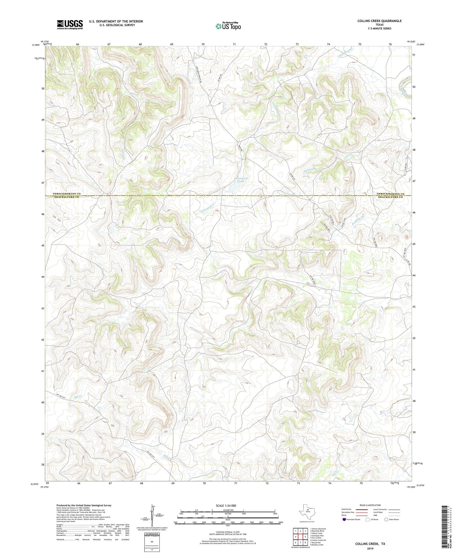
2019 topographic map quadrangle Collins Creek in the state of Texas. Scale: 1:24000. Based on the newly updated USGS 7.5' US Topo map series, this map is in the following counties: Shackelford, Throckmorton. The map contains contour data, water features, and other items you are used to seeing on USGS maps, but also has updated roads and other features. This is the next generation of topographic maps. Printed on high-quality waterproof paper with UV fade-resistant inks.
Quads adjacent to this one:
West: Antelope Hills
Northwest: Hoover Mountain
North: Reynolds Bend
Northeast: Sibley Creek
East: Fort Griffin
Southeast: Murphy Creek
South: Round Hill
Southwest: Collins Creek SW
Contains the following named places: Lambshead Tank, Lambshead Tank Dam, Matthews Ranch


