MyTopo
Fort Griffin Texas US Topo Map
Couldn't load pickup availability
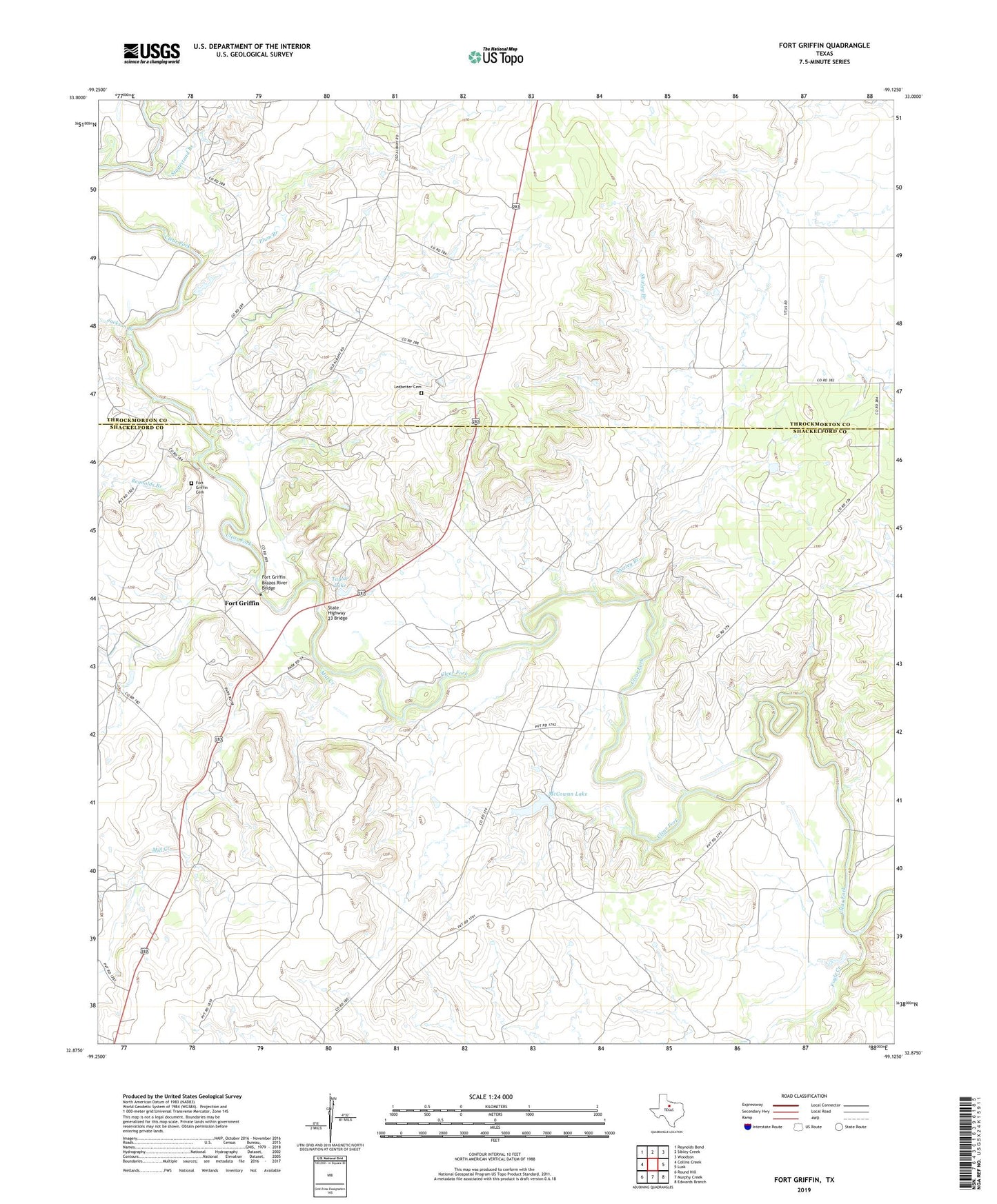
2022 topographic map quadrangle Fort Griffin in the state of Texas. Scale: 1:24000. Based on the newly updated USGS 7.5' US Topo map series, this map is in the following counties: Shackelford, Throckmorton. The map contains contour data, water features, and other items you are used to seeing on USGS maps, but also has updated roads and other features. This is the next generation of topographic maps. Printed on high-quality waterproof paper with UV fade-resistant inks.
Quads adjacent to this one:
West: Collins Creek
Northwest: Reynolds Bend
North: Sibley Creek
Northeast: Woodson
East: Lusk
Southeast: Edwards Branch
South: Murphy Creek
Southwest: Round Hill
This map covers the same area as the classic USGS quad with code o32099h2.
Contains the following named places: Collins Creek, Fort Griffin, Fort Griffin Brazos River Bridge, Fort Griffin Cemetery, Fort Griffin State Historical Park, Fort Griffin State Historical Park Trail, Fort Griffin State Park, Foyle Creek, Jackson Branch, Lambshead Creek, Ledbetter Cemetery, McCowan Lake, McCowan Lake Dam, Mill Creek, Murphy Creek, Plum Branch, Reynolds Branch, Shirley Branch, Stagestand Branch, State Highway 23 Bridge, Taylor Lake, Taylor Lake Dam