MyTopo
Concrete Texas US Topo Map
Couldn't load pickup availability
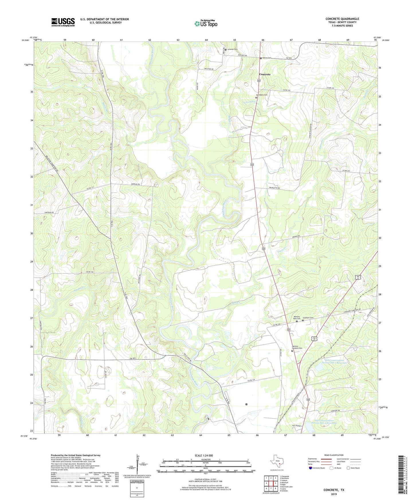
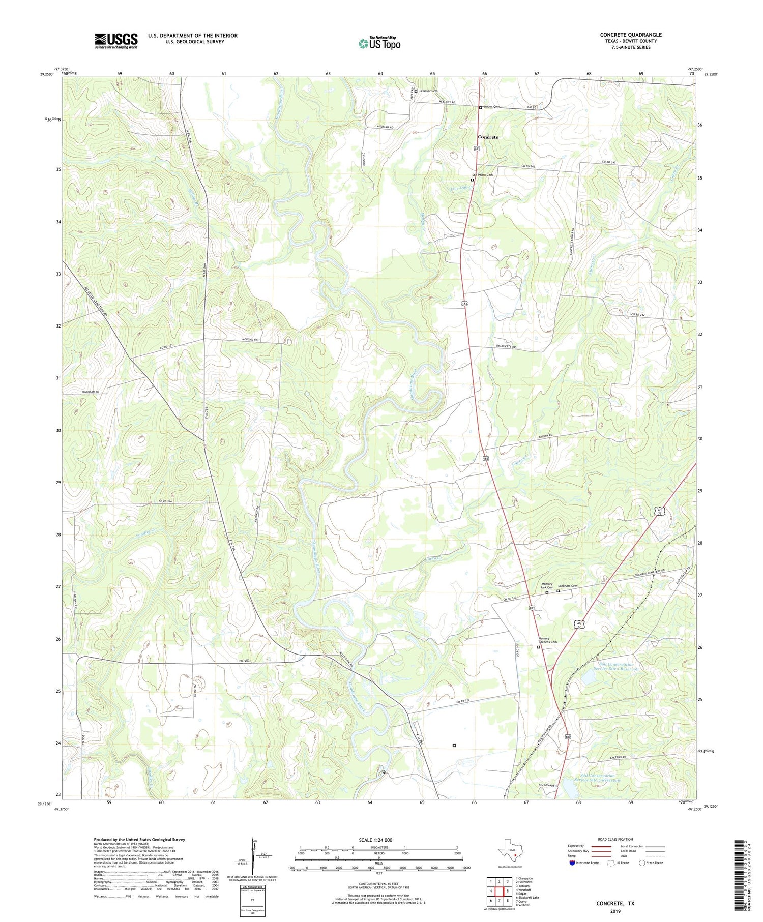
2019 topographic map quadrangle Concrete in the state of Texas. Scale: 1:24000. Based on the newly updated USGS 7.5' US Topo map series, this map is in the following counties: DeWitt. The map contains contour data, water features, and other items you are used to seeing on USGS maps, but also has updated roads and other features. This is the next generation of topographic maps. Printed on high-quality waterproof paper with UV fade-resistant inks.
Quads adjacent to this one:
West: Westhoff
Northwest: Cheapside
North: Hochheim
Northeast: Yoakum
East: Edgar
Southeast: Verhelle
South: Cuero
Southwest: Blackwell Lake
Contains the following named places: Buchel, Buchel Community Center, Concrete, Cuero Creek, Cuero Dam, Cuero Hydroelectric Plant, Cuero Lake, Leissner Cemetery, Live Oak Creek, Lockhart Cemetery, McCoy Creek, Memory Gardens Cemetery, Memory Park Cemetery, Nelms Cemetery, New Hope Church, San Pedro Cemetery, Soil Conservation Service Site 1 Dam, Soil Conservation Service Site 1 Reservoir, Soil Conservation Service Site 2 Dam, Soil Conservation Service Site 2 Reservoir, Texas Department of Criminal Justice Clarence N Stevenson Unit, Valley View School, Willow Branch